ملف:CphUrbanAreaOnPoliticalMap2.png

حجم هذه المعاينة: 662 × 600 بكسل. البعد الآخر: 743 × 673 بكسل.
الملف الأصلي (743 × 673 بكسل حجم الملف: 144 كيلوبايت، نوع MIME: image/png)
وصف قصير
| ⧼wm-license-information-description⧽ |
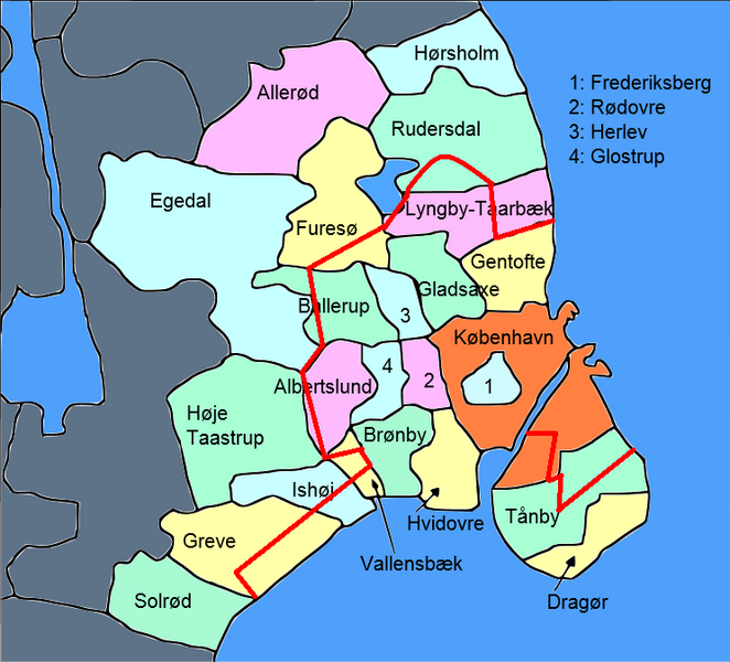
English: Political map of Copenhagen and surroundings with urban area of the city of Copenhagen marked
|
| ⧼wm-license-information-date⧽ | 2014, {{time}} – invalid date format 02 (help) |
| ⧼wm-license-information-source⧽ | File:Central+suburban Copenhagen.PNG |
| ⧼wm-license-information-author⧽ | Kaare Dybvad |
ترخيص
|
|
هذا العمل مرخّص تحت رخصة المشاع الإبداعي الملزمة بنسبة العمل لمؤلفه وبترخيص الأعمال المشتقة بالمثل 4.0. |
تاريخ الملف
اضغط على زمن/تاريخ لرؤية الملف كما بدا في هذا الزمن.
| زمن/تاريخ | صورة مصغرة | الأبعاد | مستخدم | تعليق | |
|---|---|---|---|---|---|
| حالي | ★ مراجعة معتمدة 05:12، 13 أكتوبر 2023 | | 743 × 673 (144 كيلوبايت) | Pastakhov (نقاش | مساهمات) | Upload https://upload.wikimedia.org/wikipedia/commons/c/ca/CphUrbanAreaOnPoliticalMap2.png |
لا يمكنك استبدال هذا الملف.
وصلات
لا يوجد صفحات تصل لهذه الصورة.