ملف:Cove Fort, UT, I-15 and I-70 Junction (6003081424).jpg

حجم هذه المعاينة: 800 × 568 بكسل. البعد الآخر: 1٬952 × 1٬386 بكسل.
الملف الأصلي (1٬952 × 1٬386 بكسل حجم الملف: 835 كيلوبايت، نوع MIME: image/jpeg)
وصف قصير
| ⧼wm-license-information-description⧽ |
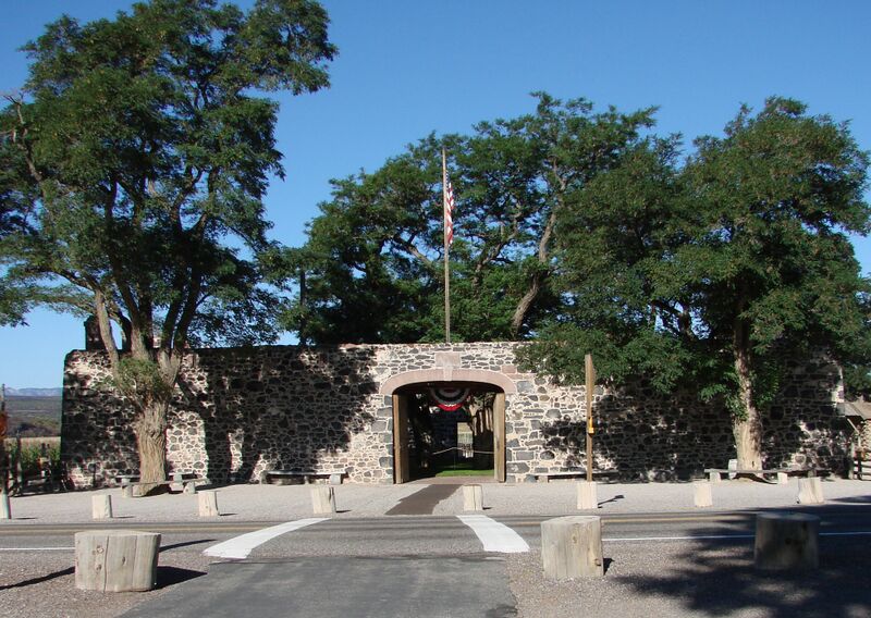
English: (1 of a 15-picture set)
I am a sucker for anything that has to do with the history of this great land. Just east of the intersection of I-15 and I-70 there is an exit for Cove Fort. This was one of the earliest sites of Mormon occupation in the future State of Utah. It has been very well restored, and seems like an oasis in a barren land. |
| ⧼wm-license-information-date⧽ | 2007, {{time}} – invalid date format 00 (help) |
| ⧼wm-license-information-source⧽ | https://www.flickr.com/photos/23155134@N06/6003081424/ |
| ⧼wm-license-information-author⧽ | inkknife_2000 (7.5 million views +) |
| ⧼wm-license-information-permission⧽ (⧼wm-license-information-permission-reusing-text⧽) |
|
| Flickr sets |
|
| Flickr pools |
|
| Flickr tags |
|
38°36′13″N 112°34′17″W / 38.603724°N 112.571411°W
.jpg¶ms=38.603724_N_112.571411_W_)
ترخيص
تاريخ الملف
اضغط على زمن/تاريخ لرؤية الملف كما بدا في هذا الزمن.
| زمن/تاريخ | صورة مصغرة | الأبعاد | مستخدم | تعليق | |
|---|---|---|---|---|---|
| حالي | ★ مراجعة معتمدة 13:10، 12 ديسمبر 2023 | | 1٬952 × 1٬386 (835 كيلوبايت) | Pastakhov (نقاش | مساهمات) | Upload https://upload.wikimedia.org/wikipedia/commons/4/4c/Cove_Fort%2C_UT%2C_I-15_and_I-70_Junction_%286003081424%29.jpg |
لا يمكنك استبدال هذا الملف.
وصلات
لا يوجد صفحات تصل لهذه الصورة.
.jpg&oldid=3745805)