ملف:County of Hoorne.png
لا توجد دقة أعلى متوفرة.
County_of_Hoorne.png (332 × 318 بكسل حجم الملف: 214 كيلوبايت، نوع MIME: image/png)
وصف قصير
| ⧼wm-license-information-description⧽ |
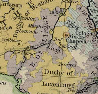
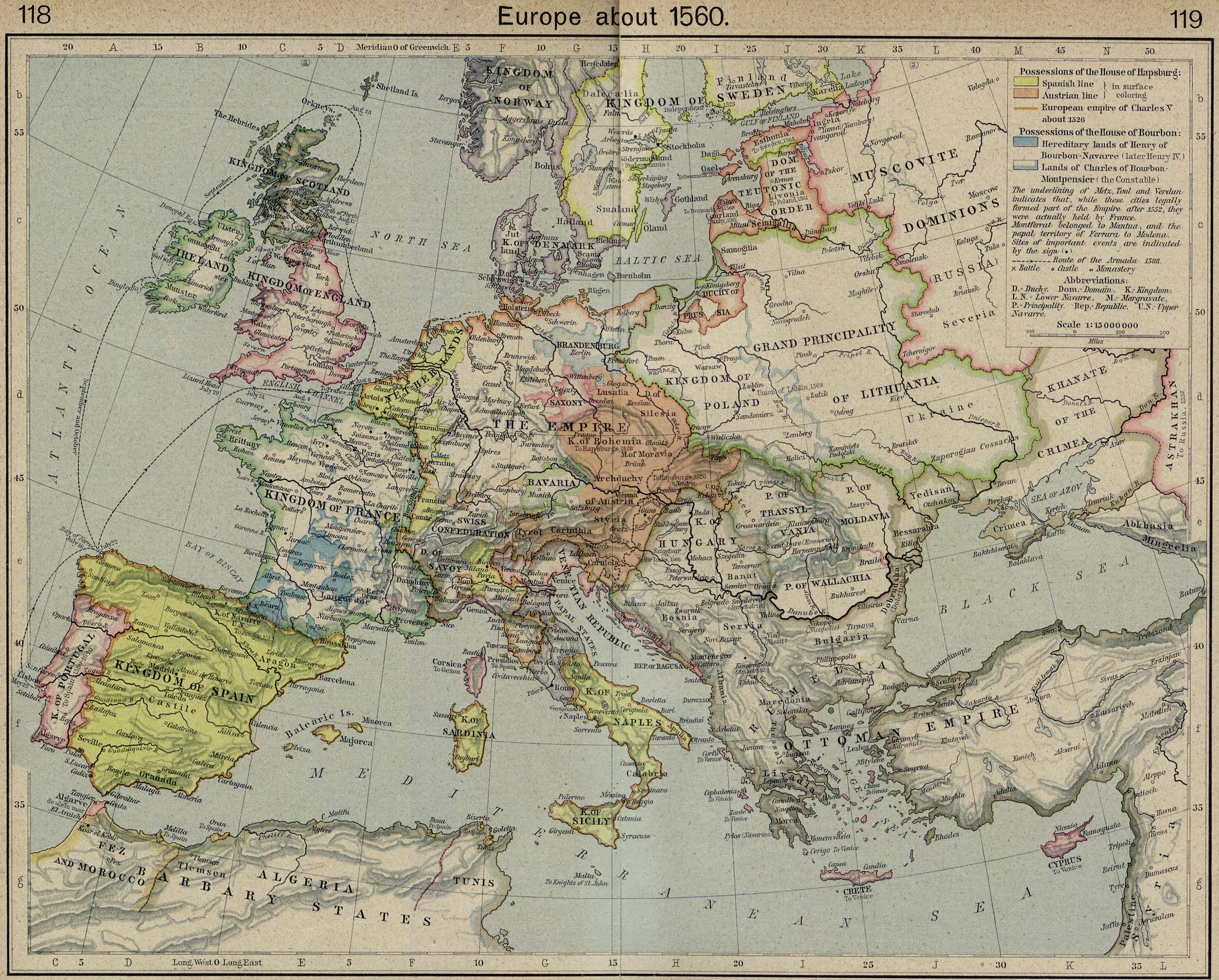
Map showing the Prince-Bishopric of Liège and the County of Horne |
| ⧼wm-license-information-date⧽ | 2007 |
| ⧼wm-license-information-source⧽ | Excerpted from Europe about 1560. From The Historical Atlas by William R. Shepherd, 1923 |
| ⧼wm-license-information-author⧽ | William R. Shepherd |
ترخيص
هذه الصورة هي ضمن الملكية عامة بسبب إنتهاء فترة صلاحية حقوقها في الولايات المتحدة الأمريكية و أي دولة أخرى ينص قانونها على مرور 70 سنة كحد أعلى على وفاة المنتج لإنتهاء صلاحية الحقوق.
تاريخ الملف
اضغط على زمن/تاريخ لرؤية الملف كما بدا في هذا الزمن.
| زمن/تاريخ | صورة مصغرة | الأبعاد | مستخدم | تعليق | |
|---|---|---|---|---|---|
| حالي | ★ مراجعة معتمدة 15:27، 10 نوفمبر 2023 | | 332 × 318 (214 كيلوبايت) | Pastakhov (نقاش | مساهمات) | Upload https://upload.wikimedia.org/wikipedia/commons/7/7c/County_of_Hoorne.png |
لا يمكنك استبدال هذا الملف.
وصلات
لا يوجد صفحات تصل لهذه الصورة.
معلومات الصورة (ميتا)
تصنيفات:
- صور مات راسمها قبل 100 عام
- 1920s maps of Belgium
- Maps showing history by William R. Shepherd
- Maps in the Perry-Castañeda Library
- County of Horne
- Prince-Bishopric of Liège
- Maps of the history of Brabant
- County of Namur
- Maps of the Duchy of Limburg
- Duchy of Luxembourg
- Duchy of Jülich
- Maps showing 1560
- 1920s maps showing history