ملف:County Durham Council UK locator map.svg

حجم معاينة PNG لذلك الملف ذي الامتداد SVG: 800 × 524 بكسل. البعد الآخر: 2٬560 × 1٬678 بكسل.
الملف الأصلي (ملف SVG، أبعاده 1٬425 × 934 بكسل، حجم الملف: 756 كيلوبايت)
| ⧼wm-license-information-description⧽ |
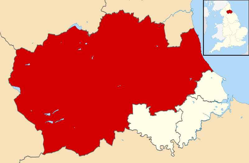
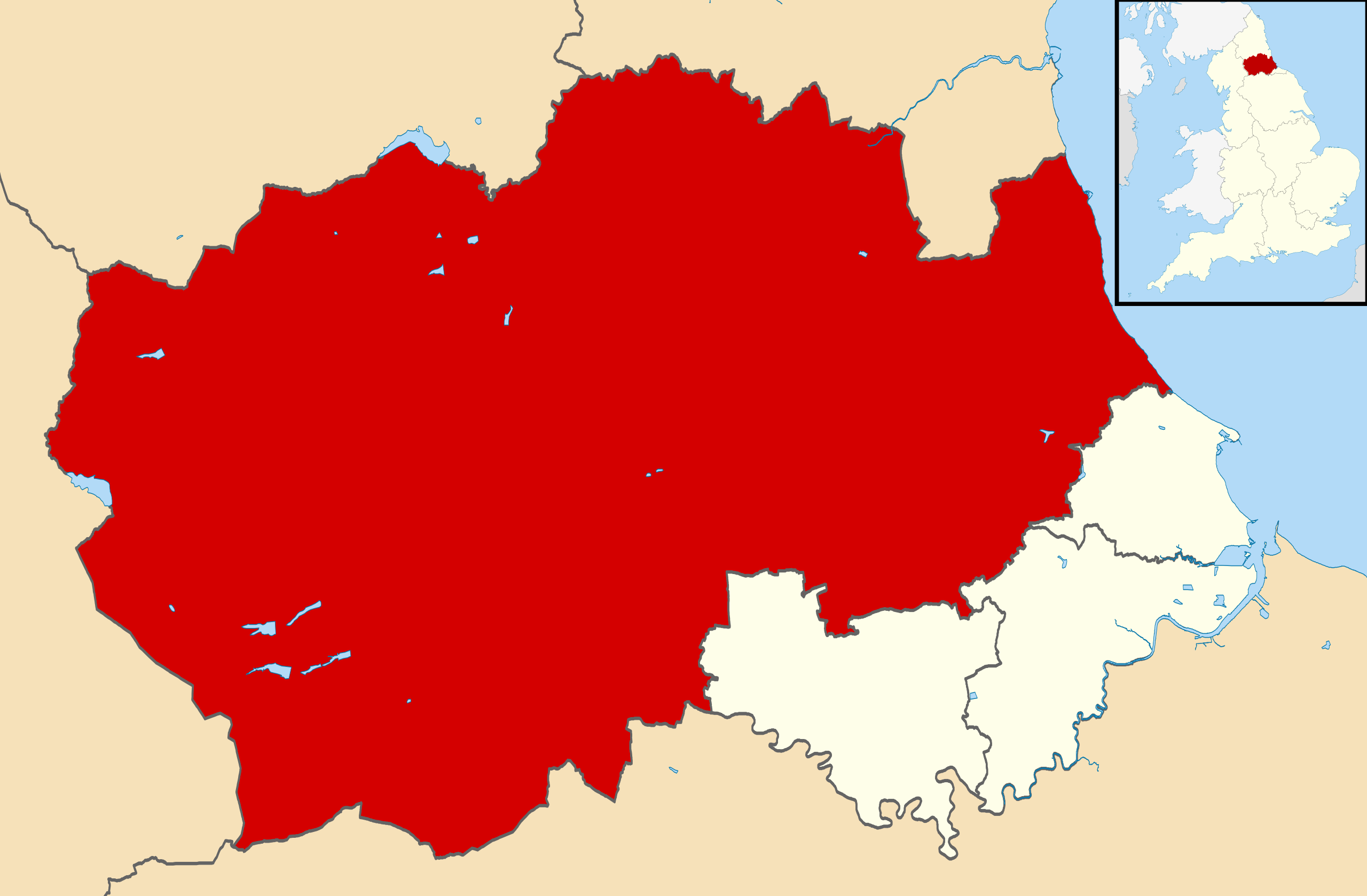
Map of County Durham, UK with County Durham council highlighted. Equirectangular map projection on WGS 84 datum, with N/S stretched 170% |
||
| ⧼wm-license-information-date⧽ | 2013 | ||
| ⧼wm-license-information-source⧽ | Ordnance Survey OpenData. Most data from Boundary-Line product. Lake data from Meridian 2 product. Inset derived from England location map.svg by Spischot. | ||
| ⧼wm-license-information-author⧽ | Nilfanion, created using Ordnance Survey data | ||
| ⧼wm-license-information-permission⧽ (⧼wm-license-information-permission-reusing-text⧽) |
|
تاريخ الملف
اضغط على زمن/تاريخ لرؤية الملف كما بدا في هذا الزمن.
| زمن/تاريخ | صورة مصغرة | الأبعاد | مستخدم | تعليق | |
|---|---|---|---|---|---|
| حالي | ★ مراجعة معتمدة 01:43، 9 نوفمبر 2023 | | 1٬425 × 934 (756 كيلوبايت) | Pastakhov (نقاش | مساهمات) | Upload https://upload.wikimedia.org/wikipedia/commons/5/5f/County_Durham_Council_UK_locator_map.svg |
لا يمكنك استبدال هذا الملف.
وصلات
لا يوجد صفحات تصل لهذه الصورة.