ملف:Corsica-geographic map-en.svg

حجم معاينة PNG لذلك الملف ذي الامتداد SVG: 327 × 599 بكسل. البعد الآخر: 1٬118 × 2٬048 بكسل.
الملف الأصلي (ملف SVG، أبعاده 2٬200 × 4٬030 بكسل، حجم الملف: 14٫15 ميجابايت)
وصف قصير
قالب:Igen
| ⧼wm-license-information-description⧽ |
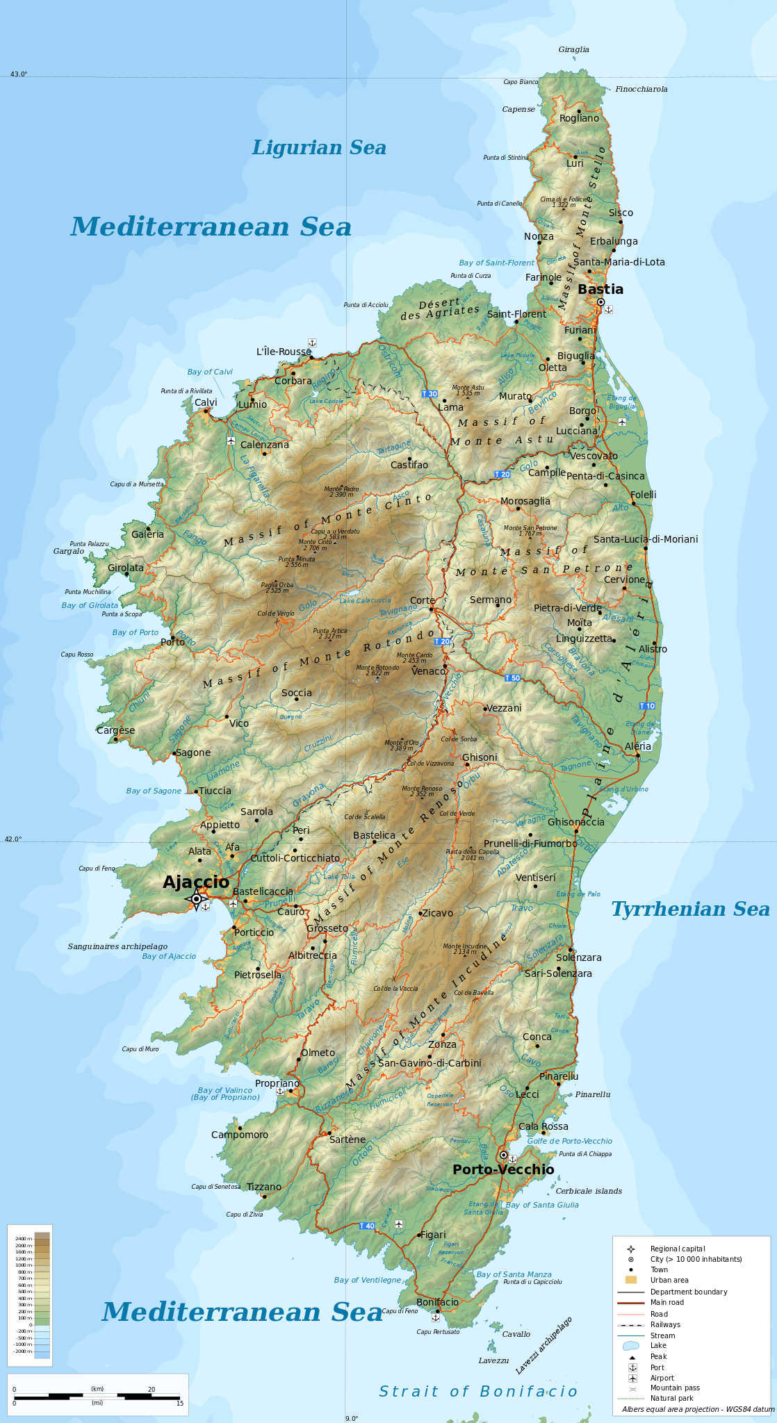
English: Geographic map of Corsica in English. Limits of the map: Français : Carte géographique de la قالب:Wf en anglais. Limites de la carte:
Albers equal area projection; WGS 84 datum |
| ⧼wm-license-information-date⧽ | 2019 |
| ⧼wm-license-information-source⧽ | ⧼Wm-license-own-work⧽
|
| ⧼wm-license-information-author⧽ | Ikonact |
| ⧼wm-license-information-permission⧽ (⧼wm-license-information-permission-reusing-text⧽) |
Any use of this map is subject of the license(s) stated below with the condition that you credit (Wikimedia Commons user: Ikonact) as the author . A message with a reply address would also be greatly appreciated. |
| ⧼wm-license-information-other-versions⧽ |
ترخيص
|
تاريخ الملف
اضغط على زمن/تاريخ لرؤية الملف كما بدا في هذا الزمن.
| زمن/تاريخ | صورة مصغرة | الأبعاد | مستخدم | تعليق | |
|---|---|---|---|---|---|
| حالي | ★ مراجعة معتمدة 15:03، 16 أكتوبر 2023 | | 2٬200 × 4٬030 (14٫15 ميجابايت) | Pastakhov (نقاش | مساهمات) | Upload https://upload.wikimedia.org/wikipedia/commons/a/a9/Corsica-geographic_map-en.svg |
لا يمكنك استبدال هذا الملف.
وصلات
لا يوجد صفحات تصل لهذه الصورة.