ملف:Conneaut Ohio aerial view.jpg

حجم هذه المعاينة: 800 × 561 بكسل. البعد الآخر: 1٬500 × 1٬052 بكسل.
الملف الأصلي (1٬500 × 1٬052 بكسل حجم الملف: 697 كيلوبايت، نوع MIME: image/jpeg)
وصف قصير
| ⧼wm-license-information-description⧽ |
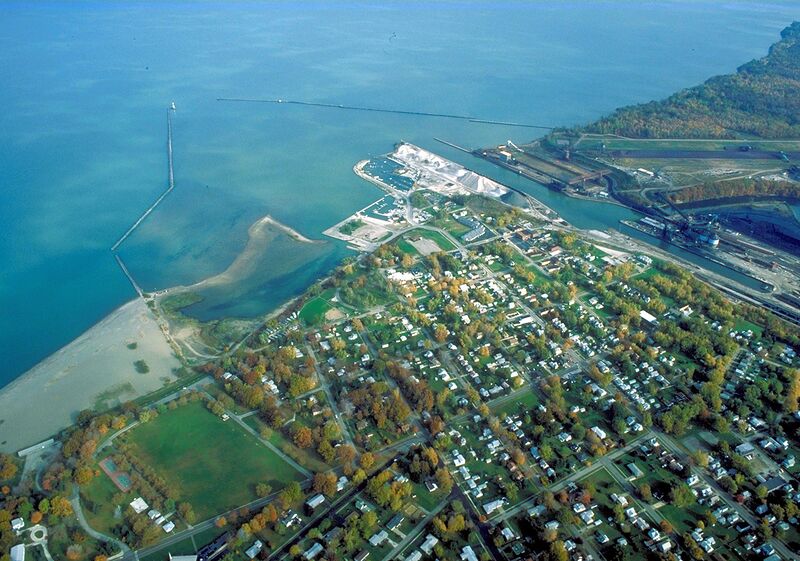
English: Aerial view of the port and harbor at Conneaut, Ohio, USA, on Lake Erie. View is to the northeast over the lake.
|
| ⧼wm-license-information-date⧽ | قالب:Taken on |
| ⧼wm-license-information-source⧽ | U.S. Army Corps of Engineers Digital Visual Library Image page Image description page Digital Visual Library home page |
| ⧼wm-license-information-author⧽ | Ken Winters, U.S. Army Corps of Engineers |
| قالب:Location/i18n | Conneaut, Ohio, USA |
41°57′54.5″N 80°33′10.96″W / 41.965139°N 80.5530444°W
ترخيص
تاريخ الملف
اضغط على زمن/تاريخ لرؤية الملف كما بدا في هذا الزمن.
| زمن/تاريخ | صورة مصغرة | الأبعاد | مستخدم | تعليق | |
|---|---|---|---|---|---|
| حالي | ★ مراجعة معتمدة 06:32، 9 نوفمبر 2023 | | 1٬500 × 1٬052 (697 كيلوبايت) | Pastakhov (نقاش | مساهمات) | Upload https://upload.wikimedia.org/wikipedia/commons/9/9a/Conneaut_Ohio_aerial_view.jpg |
لا يمكنك استبدال هذا الملف.
وصلات
لا يوجد صفحات تصل لهذه الصورة.