ملف:Coniston Watermap.jpg

حجم هذه المعاينة: 223 × 598 بكسل. البعد الآخر: 331 × 887 بكسل.
الملف الأصلي (331 × 887 بكسل حجم الملف: 56 كيلوبايت، نوع MIME: image/jpeg)
وصف قصير
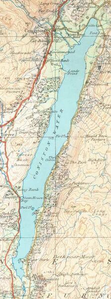
Coniston Water on a 1925 Ordnance Survey map
- This work is in the public domain because it is an Ordnance Survey map over 50 years old. Ordnance Survey maps are covered by crown copyright which in this case expires 50 years after publication. Ordnance Survey does however ask that they be credited and that the date of publication be given. Any ancillary rights gained through the creation of the electronic version are granted as freely usable under any circumstances.
ترخيص
تاريخ الملف
اضغط على زمن/تاريخ لرؤية الملف كما بدا في هذا الزمن.
| زمن/تاريخ | صورة مصغرة | الأبعاد | مستخدم | تعليق | |
|---|---|---|---|---|---|
| حالي | ★ مراجعة معتمدة 08:27، 16 أكتوبر 2023 | 331 × 887 (56 كيلوبايت) | Pastakhov (نقاش | مساهمات) | Upload https://upload.wikimedia.org/wikipedia/commons/c/c5/Coniston_Watermap.jpg |
لا يمكنك استبدال هذا الملف.
وصلات
لا يوجد صفحات تصل لهذه الصورة.