ملف:Congo-Brazzaville.png
لا توجد دقة أعلى متوفرة.
Congo-Brazzaville.png (100 × 116 بكسل حجم الملف: 3 كيلوبايت، نوع MIME: image/png)
| ⧼wm-license-information-description⧽ |
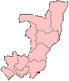
Map of the Republic of the Congo showing Brazzaville commune. (تركيا) |
| ⧼wm-license-information-date⧽ | 2004 |
| ⧼wm-license-information-source⧽ | Self-made, traced from public domain UN or CIA maps. |
| ⧼wm-license-information-author⧽ | User:Golbez |
| ⧼wm-license-information-permission⧽ (⧼wm-license-information-permission-reusing-text⧽) |
Provide attribution, please. See below. |
| ⧼wm-license-information-other-versions⧽ |
See Image:Congo regions named.png for the map of the regions. |
|

تاريخ الملف
اضغط على زمن/تاريخ لرؤية الملف كما بدا في هذا الزمن.
| زمن/تاريخ | صورة مصغرة | الأبعاد | مستخدم | تعليق | |
|---|---|---|---|---|---|
| حالي | ★ مراجعة معتمدة 16:13، 23 أكتوبر 2023 | | 100 × 116 (3 كيلوبايت) | Pastakhov (نقاش | مساهمات) | Upload https://upload.wikimedia.org/wikipedia/commons/f/fa/Congo-Brazzaville.png |
لا يمكنك استبدال هذا الملف.
وصلات
لا يوجد صفحات تصل لهذه الصورة.