ملف:Church Street, Calne - geograph.org.uk - 810871.jpg
حجم هذه المعاينة: 449 × 600 بكسل. البعد الآخر: 479 × 640 بكسل.
الملف الأصلي (479 × 640 بكسل حجم الملف: 96 كيلوبايت، نوع MIME: image/jpeg)
وصف قصير
| ⧼wm-license-information-description⧽ |
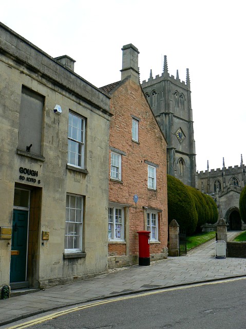
English: Church Street, Calne. In the background is The Parish Church of St Mary the Virgin. The pinkish coloured building shows the blue plaque in this image 810869 Whether the Dutch scientist had any connection with the building isn't known to me. He is, however, buried in the churchyard.
|
| ⧼wm-license-information-date⧽ | 2008 |
| ⧼wm-license-information-source⧽ | From geograph.org.uk |
| ⧼wm-license-information-author⧽ | Brian Robert Marshall |
| ⧼wm-license-cc-attribution⧽ (قالب:I18n/Credit line) |
Brian Robert Marshall / Church Street, Calne / |
51°26′16″N 2°00′13″W / 51.43777°N 2.0035°W قالب:Object location
_heading:157)
ترخيص
تاريخ الملف
اضغط على زمن/تاريخ لرؤية الملف كما بدا في هذا الزمن.
| زمن/تاريخ | صورة مصغرة | الأبعاد | مستخدم | تعليق | |
|---|---|---|---|---|---|
| حالي | ★ مراجعة معتمدة 02:35، 11 نوفمبر 2023 | | 479 × 640 (96 كيلوبايت) | Pastakhov (نقاش | مساهمات) | Upload https://upload.wikimedia.org/wikipedia/commons/8/8a/Church_Street%2C_Calne_-_geograph.org.uk_-_810871.jpg |
لا يمكنك استبدال هذا الملف.
وصلات
لا يوجد صفحات تصل لهذه الصورة.