ملف:Cherry Hill Banner.jpg
حجم هذه المعاينة: 800 × 115 بكسل. البعد الآخر: 3٬600 × 516 بكسل.
الملف الأصلي (3٬600 × 516 بكسل حجم الملف: 822 كيلوبايت، نوع MIME: image/jpeg)
وصف قصير
| ⧼wm-license-information-description⧽ |
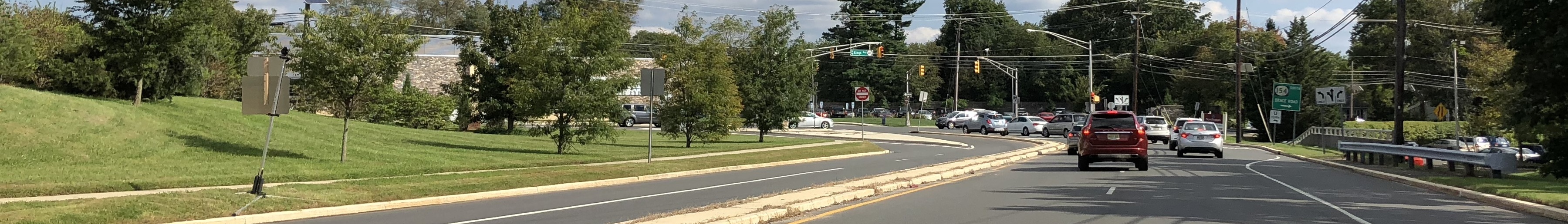
English: View north along New Jersey State Route 41 and Camden County Route 573 (Connector Road) between Kings Highway and New Jersey State Route 154 (Brace Road) in Cherry Hill Township, Camden County, New Jersey
|
| ⧼wm-license-information-date⧽ | 2018, {{time}} – invalid date format 05 (help) |
| ⧼wm-license-information-source⧽ | ⧼Wm-license-own-work⧽ |
| ⧼wm-license-information-author⧽ | Famartin |
| ⧼wm-license-information-other-versions⧽ |
39°54′44″N 75°00′42″W / 39.91215°N 75.011672°W
ترخيص
|
تاريخ الملف
اضغط على زمن/تاريخ لرؤية الملف كما بدا في هذا الزمن.
| زمن/تاريخ | صورة مصغرة | الأبعاد | مستخدم | تعليق | |
|---|---|---|---|---|---|
| حالي | ★ مراجعة معتمدة 13:39، 15 يناير 2024 | 3٬600 × 516 (822 كيلوبايت) | Pastakhov (نقاش | مساهمات) | Upload https://upload.wikimedia.org/wikipedia/commons/f/f6/Cherry_Hill_Banner.jpg |
لا يمكنك استبدال هذا الملف.
وصلات
لا يوجد صفحات تصل لهذه الصورة.