ملف:Charente-Maritime department arrondissement Rochefort.svg

حجم معاينة PNG لذلك الملف ذي الامتداد SVG: 480 × 599 بكسل. البعد الآخر: 1٬641 × 2٬048 بكسل.
الملف الأصلي (ملف SVG، أبعاده 584 × 729 بكسل، حجم الملف: 133 كيلوبايت)
وصف قصير
| ⧼wm-license-information-description⧽ |
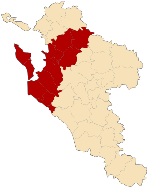
Français : Géolocalisation de l'arrondissement de Rochefort en Charente-Maritime (France).
|
| ⧼wm-license-information-date⧽ | 2009 |
| ⧼wm-license-information-source⧽ | other version of File:Charente-Maritime department cantons map-blank.svg created by Sting |
| ⧼wm-license-information-author⧽ | Droop - fr:Droop |
| ⧼wm-license-information-other-versions⧽ |
|
ترخيص
تاريخ الملف
اضغط على زمن/تاريخ لرؤية الملف كما بدا في هذا الزمن.
| زمن/تاريخ | صورة مصغرة | الأبعاد | مستخدم | تعليق | |
|---|---|---|---|---|---|
| حالي | ★ مراجعة معتمدة 18:42، 19 أكتوبر 2023 | | 584 × 729 (133 كيلوبايت) | Pastakhov (نقاش | مساهمات) | Upload https://upload.wikimedia.org/wikipedia/commons/a/aa/Charente-Maritime_department_arrondissement_Rochefort.svg |
لا يمكنك استبدال هذا الملف.
وصلات
لا يوجد صفحات تصل لهذه الصورة.