ملف:Chambers Street, Edinburgh - geograph.org.uk - 1419940.jpg
لا توجد دقة أعلى متوفرة.
Chambers_Street,_Edinburgh_-_geograph.org.uk_-_1419940.jpg (640 × 446 بكسل حجم الملف: 74 كيلوبايت، نوع MIME: image/jpeg)
وصف قصير
| ⧼wm-license-information-description⧽ |
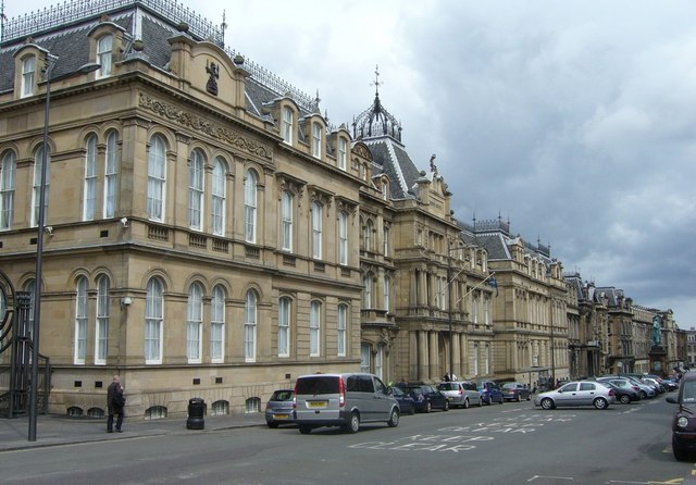
English: Chambers Street, Edinburgh. Chambers Street came about as one of the major street-planning improvements carried out in the wake of M.O.H. Henry Littlejohn's report of 1855 on sanitary conditions in the Old Town of Edinburgh. Littlejohn urged extensive slum clearance for the sake of public health which was eventually put into effect by the City Improvement Acts of 1867 and 1871. The 70-foot-wide, 1,000-foot-long street, replaced a narrow, squalid thoroughfare running alongside Old College from Adam Square at the eastern end through Argyle Square to Brown Square at the western end. These squares (along with George Square) represented the first major, southwards expansion of the town beyond its traditional boundaries before the New Town was built to the north. All three squares were demolished. The new street was named after Lord Provost William Chambers who was Littlejohn's foremost supporter in pushing for improvements. 1338463
|
| ⧼wm-license-information-date⧽ | 2009 |
| ⧼wm-license-information-source⧽ | From geograph.org.uk |
| ⧼wm-license-information-author⧽ | kim traynor |
| ⧼wm-license-cc-attribution⧽ (قالب:I18n/Credit line) |
kim traynor / Chambers Street, Edinburgh / |
55°56′51″N 3°11′26″W / 55.94738°N 3.1906°W قالب:Object location
_heading:67)
ترخيص
تاريخ الملف
اضغط على زمن/تاريخ لرؤية الملف كما بدا في هذا الزمن.
| زمن/تاريخ | صورة مصغرة | الأبعاد | مستخدم | تعليق | |
|---|---|---|---|---|---|
| حالي | ★ مراجعة معتمدة 08:50، 28 نوفمبر 2023 | | 640 × 446 (74 كيلوبايت) | Pastakhov (نقاش | مساهمات) | Upload https://upload.wikimedia.org/wikipedia/commons/c/ce/Chambers_Street%2C_Edinburgh_-_geograph.org.uk_-_1419940.jpg |
لا يمكنك استبدال هذا الملف.
وصلات
لا يوجد صفحات تصل لهذه الصورة.