ملف:Cenepa river basin.jpg

حجم هذه المعاينة: 476 × 600 بكسل. البعد الآخر: 965 × 1٬216 بكسل.
الملف الأصلي (965 × 1٬216 بكسل حجم الملف: 900 كيلوبايت، نوع MIME: image/jpeg)
وصف قصير
| ⧼wm-license-information-description⧽ |
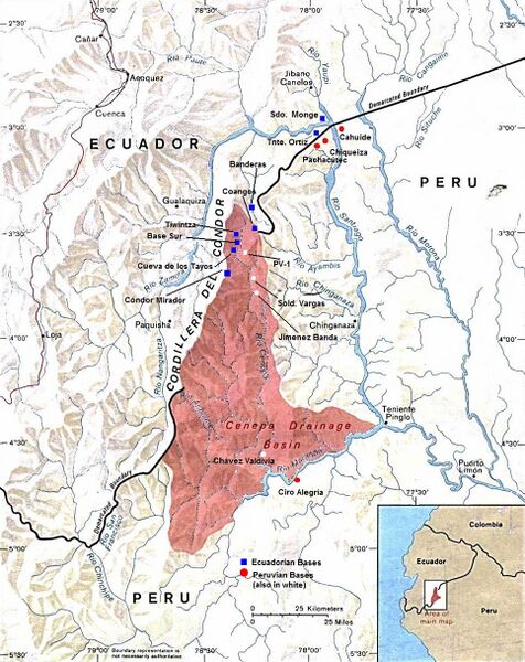
English: Peru-Ecuador (Area of Boundary Dispute).
|
| ⧼wm-license-information-date⧽ | style="background: #E4E4E4; color: black; vertical-align: middle; text-align: center; " class="unknown table-unknown"|date |
| ⧼wm-license-information-source⧽ | قالب:PCL |
| ⧼wm-license-information-author⧽ | The University of Texas at Austin |
| ⧼wm-license-information-permission⧽ (⧼wm-license-information-permission-reusing-text⧽) |
Stated as public domain. |
ترخيص
قالب:Original upload log
قالب:Original description page
- 2010-10-30 14:30 Beao 965×1216× (921862 bytes)
- 2009-10-01 21:16 Andres C. 1000×1292× (876675 bytes) A retouched image of a map located online at the University of Texas Library - PCL Map Collection website. Stated as public domain: http://www.lib.utexas.edu/maps/americas/peru_ecuador_81.jpg "Courtesy of the University of Texas Libraries, The Universit
تاريخ الملف
اضغط على زمن/تاريخ لرؤية الملف كما بدا في هذا الزمن.
| زمن/تاريخ | صورة مصغرة | الأبعاد | مستخدم | تعليق | |
|---|---|---|---|---|---|
| حالي | ★ مراجعة معتمدة 06:38، 18 ديسمبر 2023 | | 965 × 1٬216 (900 كيلوبايت) | Pastakhov (نقاش | مساهمات) | Upload https://upload.wikimedia.org/wikipedia/commons/2/2c/Cenepa_river_basin.jpg |
لا يمكنك استبدال هذا الملف.
وصلات
لا يوجد صفحات تصل لهذه الصورة.