ملف:Celts.svg

حجم معاينة PNG لذلك الملف ذي الامتداد SVG: 719 × 600 بكسل. البعد الآخر: 2٬455 × 2٬048 بكسل.
الملف الأصلي (ملف SVG، أبعاده 1٬068 × 891 بكسل، حجم الملف: 322 كيلوبايت)
وصف قصير
قالب:Igen
| ⧼wm-license-information-description⧽ |
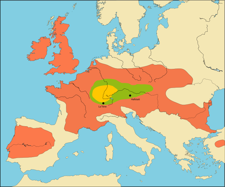
English: DO NOT USE THIS MAP
It was made in 2005 as a first draft and doesn't remotely satisfy inclusion criteria for Wikipedia. Original caption:[1]
|
| ⧼wm-license-information-date⧽ | 2009 |
| ⧼wm-license-information-source⧽ | قالب:F |
| ⧼wm-license-information-author⧽ | قالب:AutVec |
| ⧼wm-license-information-other-versions⧽ |
Better maps:قالب:G |
ترخيص
|

تاريخ الملف
اضغط على زمن/تاريخ لرؤية الملف كما بدا في هذا الزمن.
| زمن/تاريخ | صورة مصغرة | الأبعاد | مستخدم | تعليق | |
|---|---|---|---|---|---|
| حالي | ★ مراجعة معتمدة 02:58، 9 ديسمبر 2023 | | 1٬068 × 891 (322 كيلوبايت) | Pastakhov (نقاش | مساهمات) | Upload https://upload.wikimedia.org/wikipedia/commons/4/49/Celts.svg |
لا يمكنك استبدال هذا الملف.
وصلات
لا يوجد صفحات تصل لهذه الصورة.
معلومات الصورة (ميتا)
تصنيفات:
- Self-published work
- Púchov culture
- Maps of the European Iron Age
- Hallstatt culture
- La Tène culture
- Celtic culture in Germany
- Celtic culture in Poland
- Celtic culture in Slovakia
- Cremation graves in Germany
- Cremation graves in Poland
- Cremation graves in Slovakia
- Cremation graves
- Hungary in the 1st century BC
- Hungary in the 1st century
- Hungary in the 2nd century BC
- Hungary in the 2nd century
- Hungary in the 3rd century BC
- Hungary in the 3rd century
- Hungary in the 4th century
- Maps of Przeworsk culture in the 3rd century BC
- Maps of the Celts
- Podkarpackie in the 2nd century
- Poland in the 1st century BC
- Poland in the 1st century
- Poland in the 2nd century BC
- Poland in the 2nd century
- Poland in the 3rd century BC
- Poland in the 4th century BC
- Slovakia in the 1st century BC
- Slovakia in the 1st century
- Slovakia in the 2nd century BC
- Slovakia in the 2nd century
- Slovakia in the 3rd century BC
- Slovakia in the 4th century BC
- Slovakia in the 5th century BC