ملف:Caucasus topographic map with border colors-en.svg

حجم معاينة PNG لذلك الملف ذي الامتداد SVG: 771 × 599 بكسل. البعد الآخر: 2٬560 × 1٬990 بكسل.
الملف الأصلي (ملف SVG، أبعاده 1٬155 × 898 بكسل، حجم الملف: 5٫55 ميجابايت)
وصف قصير
| ⧼wm-license-information-description⧽ |
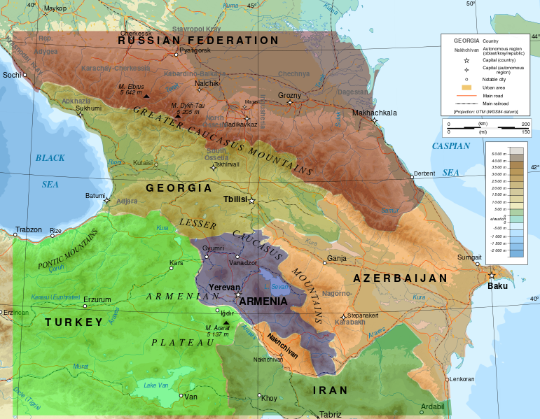
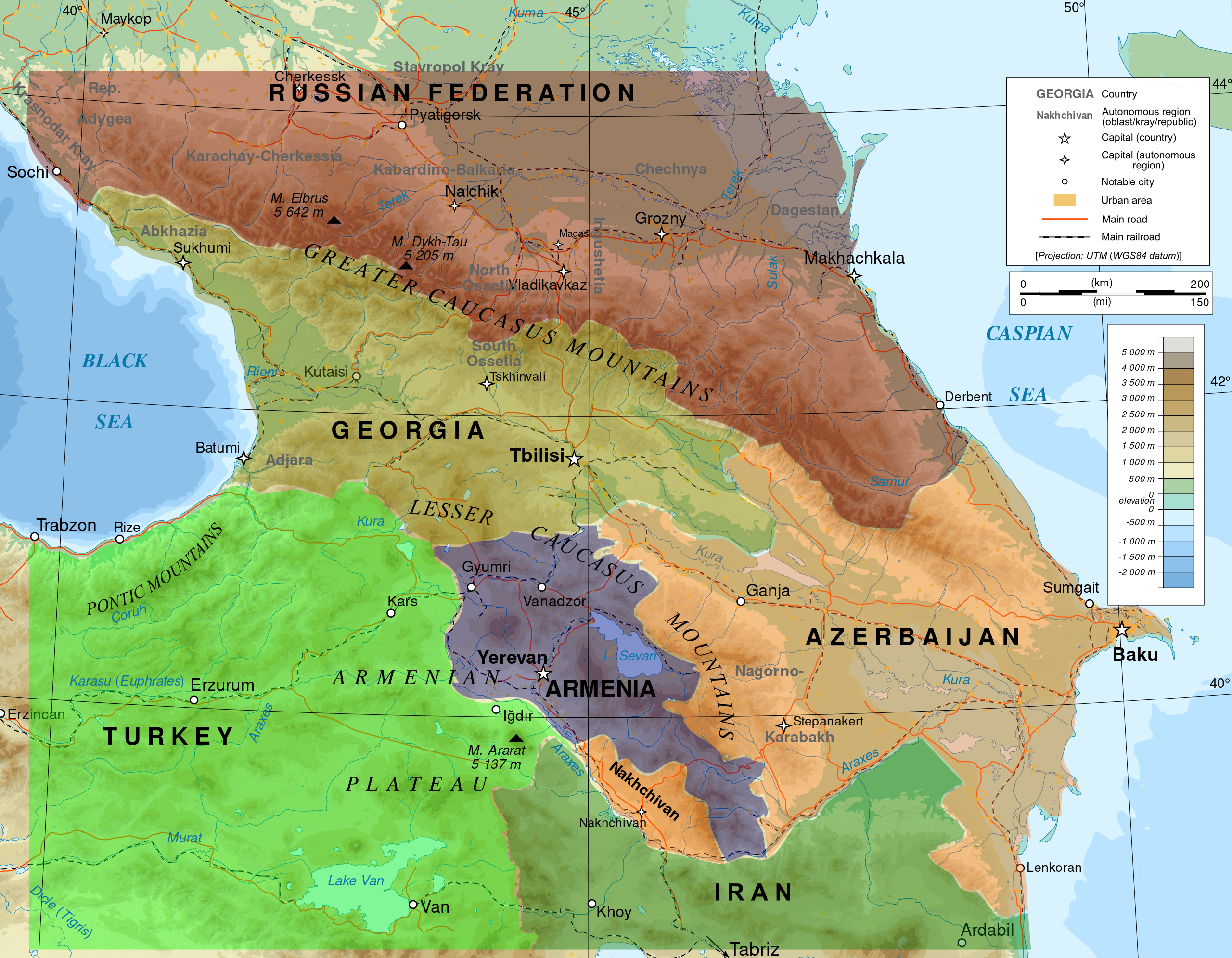
English: Topographic map of the Caucasus in English
|
| ⧼wm-license-information-date⧽ | 2016-07-23, borders colors: 2022-01-20 |
| ⧼wm-license-information-source⧽ | English: Own work ; Topographic data from the NASA Shuttle Radar Topography Mission (SRTM3 v.2) (public domain) edited with 3DEM, reprojected in UTM with GDAL (GDAL), and vectorized with Inkscape ; UTM projection ; WGS84 datum ; shaded relief (composite image of N-W, W and N lightning positions) ; Reference used for the additional data : * Rivers, cities, railroads, routes, bathymetry : Demis add-on for World Wind (see the approval e-mail and the Demis forum) ; * Borders and coast : World data bank II ; Approximate scale of topographic data : 1:1,463,000 ; Note : The shaded relief is a raster image embedded in the SVG file. Approximate geographic limits of the map (3' close) : * SW corner : 38°05'00"N – 39°33'00"E * SE corner : 38°05'00"N – 51°00'00"E * NE corner : 45°00'00"N – 51°00'00"E * NW corner : 45°00'00"N – 39°00'00"E (إندونيسية) |
| ⧼wm-license-information-author⧽ | Bourrichon - fr:Bourrichon with English translations, additions, and corrections by Ketone16 (partly following Yuri Koryakov), borders colors: Bennylin from: File:BlankMap-Caucasus.png by Kbh3rd on February 4, 2005, license GFDL. |
| ⧼wm-license-information-permission⧽ (⧼wm-license-information-permission-reusing-text⧽) |
GFDL / Attribution and Share-Alike required |
| ⧼wm-license-information-other-versions⧽ |
|
ترخيص
|

تاريخ الملف
اضغط على زمن/تاريخ لرؤية الملف كما بدا في هذا الزمن.
| زمن/تاريخ | صورة مصغرة | الأبعاد | مستخدم | تعليق | |
|---|---|---|---|---|---|
| حالي | ★ مراجعة معتمدة 17:16، 20 أكتوبر 2023 | | 1٬155 × 898 (5٫55 ميجابايت) | Pastakhov (نقاش | مساهمات) | Upload https://upload.wikimedia.org/wikipedia/commons/f/f8/Caucasus_topographic_map_with_border_colors-en.svg |
لا يمكنك استبدال هذا الملف.
وصلات
لا يوجد صفحات تصل لهذه الصورة.