ملف:Catarina 27 mar 2004 1355Z.jpg
الملف الأصلي (4٬400 × 3٬400 بكسل حجم الملف: 2٫85 ميجابايت، نوع MIME: image/jpeg)
وصف قصير
| ⧼wm-license-information-description⧽ |
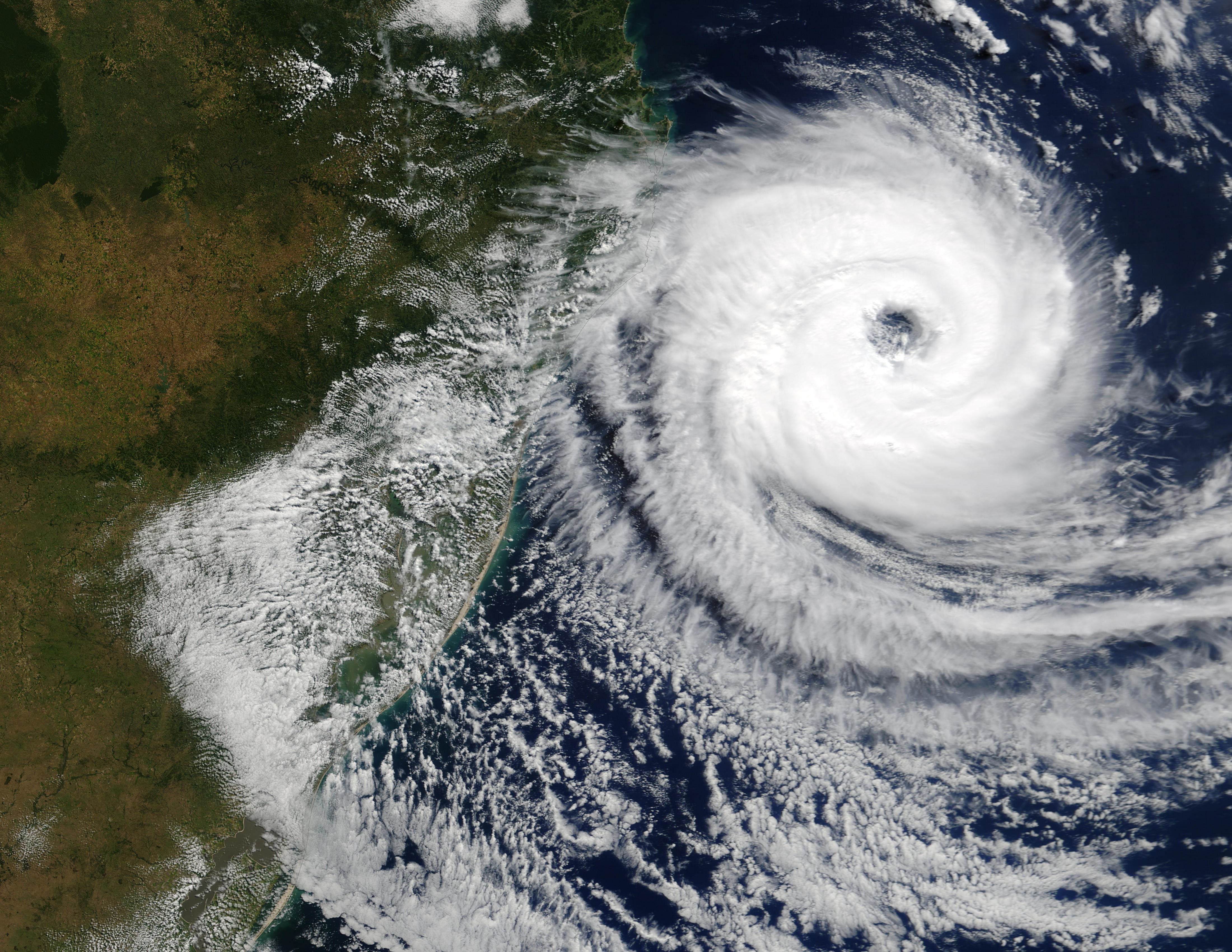
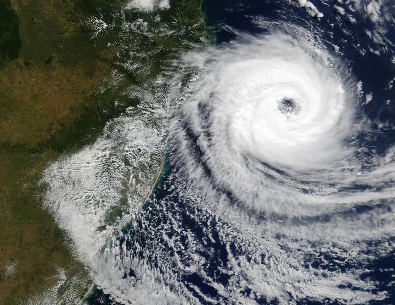
The Moderate Resolution Imaging Spectroradiometer (MODIS) onboard NASA’s Aqua satellite captured this true-color image of a rare tropical cyclone in the South Atlantic ocean just off the coast of Santa Catarina and Rio Grande do Sul, Brazil’s southernmost states on March 27, 2004. The National Hurricane Center in Miami estimated the storm was a full-fledged, Category I hurricane with central winds between 75 mph and 80 mph (121 kph to 129 kph), making it the first hurricane in the South Atlantic in recorded history. Brazilian scientists however, have disagreed, saying the storm had top winds of 50 mph to 56 mph (80 kph to 90 kph), far below the 75 mph (121 kph) threshold of a hurricane. It's interesting to note that the Brazilian Center for Weather Prediction and Climatic Studies does not operate any anemometers (wind measuring devices) in the area or have any Hurricane Hunter aircraft to fly through the storm. All sides were basing their guesses on satellite data only. |
||
| ⧼wm-license-information-date⧽ | 2004 | ||
| ⧼wm-license-information-source⧽ | http://visibleearth.nasa.gov/view_rec.php?id=6446 | ||
| ⧼wm-license-information-author⧽ | Jacques Descloitres, MODIS Rapid Response Team, NASA/GSFC | ||
| ⧼wm-license-information-permission⧽ (⧼wm-license-information-permission-reusing-text⧽) |
|
تاريخ الملف
اضغط على زمن/تاريخ لرؤية الملف كما بدا في هذا الزمن.
| زمن/تاريخ | صورة مصغرة | الأبعاد | مستخدم | تعليق | |
|---|---|---|---|---|---|
| حالي | ★ مراجعة معتمدة 15:34، 9 نوفمبر 2023 | | 4٬400 × 3٬400 (2٫85 ميجابايت) | Pastakhov (نقاش | مساهمات) | Upload https://upload.wikimedia.org/wikipedia/commons/c/c2/Catarina_27_mar_2004_1355Z.jpg |
لا يمكنك استبدال هذا الملف.
وصلات
لا يوجد صفحات تصل لهذه الصورة.