ملف:Carte topographique Elbrouz.svg

حجم معاينة PNG لذلك الملف ذي الامتداد SVG: 800 × 560 بكسل. البعد الآخر: 2٬560 × 1٬792 بكسل.
الملف الأصلي (ملف SVG، أبعاده 1٬454 × 1٬018 بكسل، حجم الملف: 6٫63 ميجابايت)
وصف قصير
| ⧼wm-license-information-description⧽ |
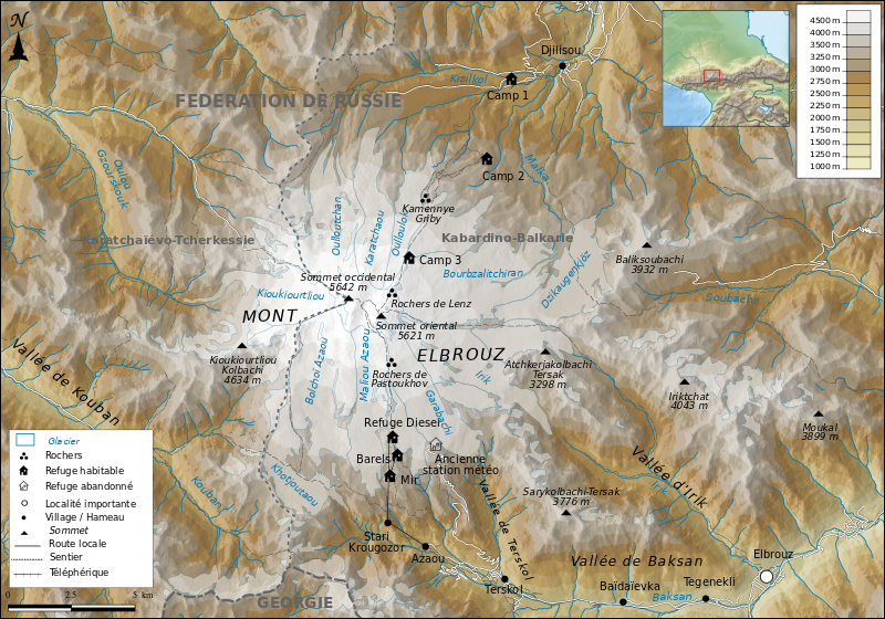
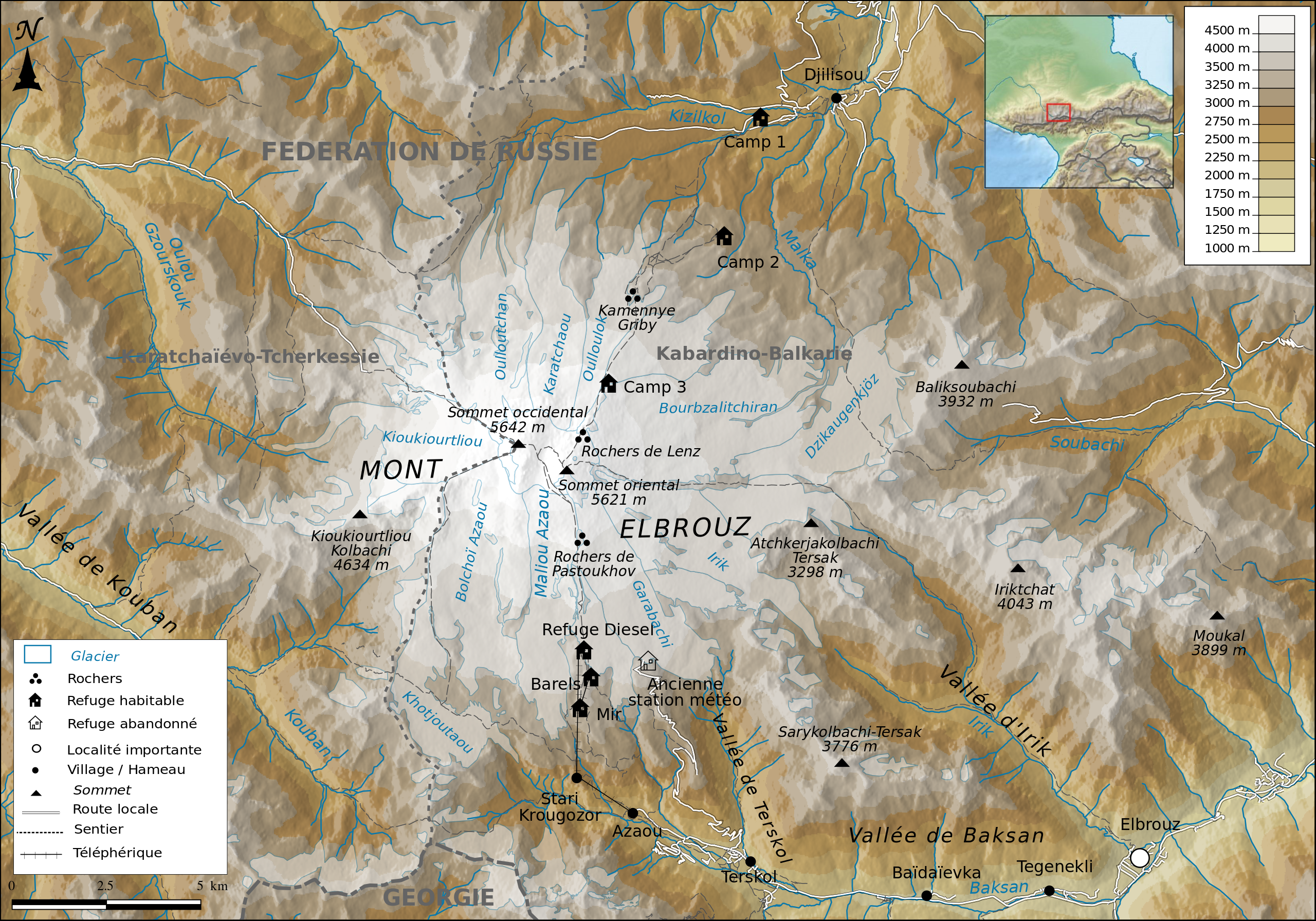
Français : Carte topographique du Mont Elbrouz
|
| ⧼wm-license-information-date⧽ | 2017 |
| ⧼wm-license-information-source⧽ | ⧼Wm-license-own-work⧽
Relief : STRM1 v2 Hydrologie, routes et limites administratives : Openstreetmap |
| ⧼wm-license-information-author⧽ | Boldair |
ترخيص
|
تاريخ الملف
اضغط على زمن/تاريخ لرؤية الملف كما بدا في هذا الزمن.
| زمن/تاريخ | صورة مصغرة | الأبعاد | مستخدم | تعليق | |
|---|---|---|---|---|---|
| حالي | ★ مراجعة معتمدة 21:40، 26 أكتوبر 2023 | | 1٬454 × 1٬018 (6٫63 ميجابايت) | Pastakhov (نقاش | مساهمات) | Upload https://upload.wikimedia.org/wikipedia/commons/0/05/Carte_topographique_Elbrouz.svg |
لا يمكنك استبدال هذا الملف.
وصلات
لا يوجد صفحات تصل لهذه الصورة.