ملف:Carte des meurtres de 1888 à 1891 à Whitechapel (Londres).jpg
حجم هذه المعاينة: 800 × 565 بكسل. البعد الآخر: 1٬754 × 1٬239 بكسل.
الملف الأصلي (1٬754 × 1٬239 بكسل حجم الملف: 2٫47 ميجابايت، نوع MIME: image/jpeg)
وصف قصير
| ⧼wm-license-information-description⧽ |
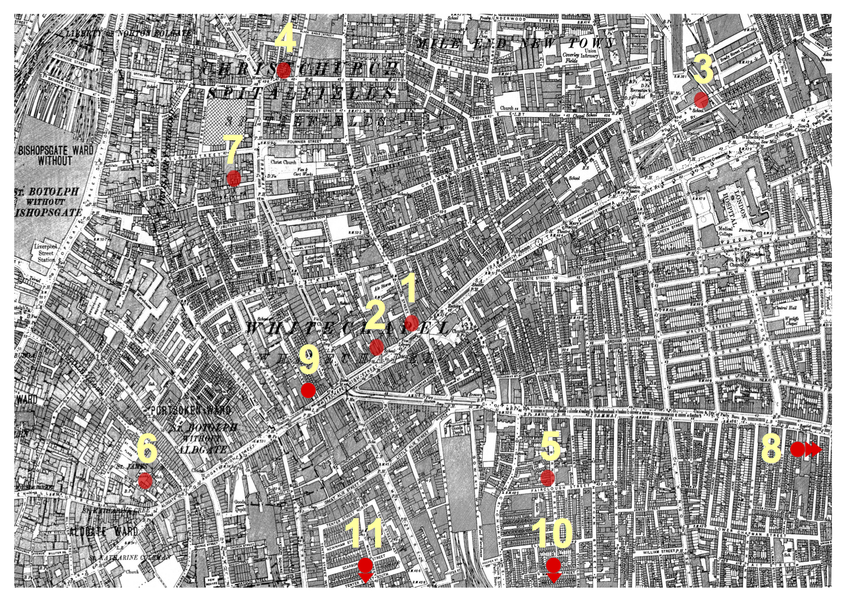
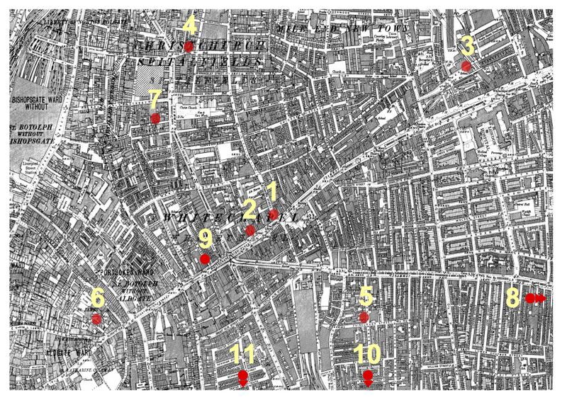
Français : Carte des meurtres ayant eu lieu entre le 3 avril 1888 et le 13 février 1891à Whitechapel comportant 11 points rouges numérotés.
|
| ⧼wm-license-information-date⧽ | 2015 |
| ⧼wm-license-information-source⧽ | 1894 Ordnance Survey Map of Whitechapel downloaded from http://www.casebook.org/official_documents/map/images/ord_map_full.jpg Cropped and annotated with eleven red dots to show the location of seven murders attributed to Jack the Ripper |
| ⧼wm-license-information-author⧽ | Ordnance Survey; modified by User:ΑΩ ; modified by Utilisateur:Crijam |
ترخيص
تاريخ الملف
اضغط على زمن/تاريخ لرؤية الملف كما بدا في هذا الزمن.
| زمن/تاريخ | صورة مصغرة | الأبعاد | مستخدم | تعليق | |
|---|---|---|---|---|---|
| حالي | ★ مراجعة معتمدة 00:54، 5 نوفمبر 2023 | | 1٬754 × 1٬239 (2٫47 ميجابايت) | Pastakhov (نقاش | مساهمات) | Upload https://upload.wikimedia.org/wikipedia/commons/e/e9/Carte_des_meurtres_de_1888_%C3%A0_1891_%C3%A0_Whitechapel_%28Londres%29.jpg |
لا يمكنك استبدال هذا الملف.
وصلات
لا يوجد صفحات تصل لهذه الصورة.
.jpg&oldid=3377832)