ملف:Carolinacolony.png
حجم هذه المعاينة: 572 × 599 بكسل. البعد الآخر: 1٬000 × 1٬048 بكسل.
الملف الأصلي (1٬000 × 1٬048 بكسل حجم الملف: 419 كيلوبايت، نوع MIME: image/png)
وصف قصير
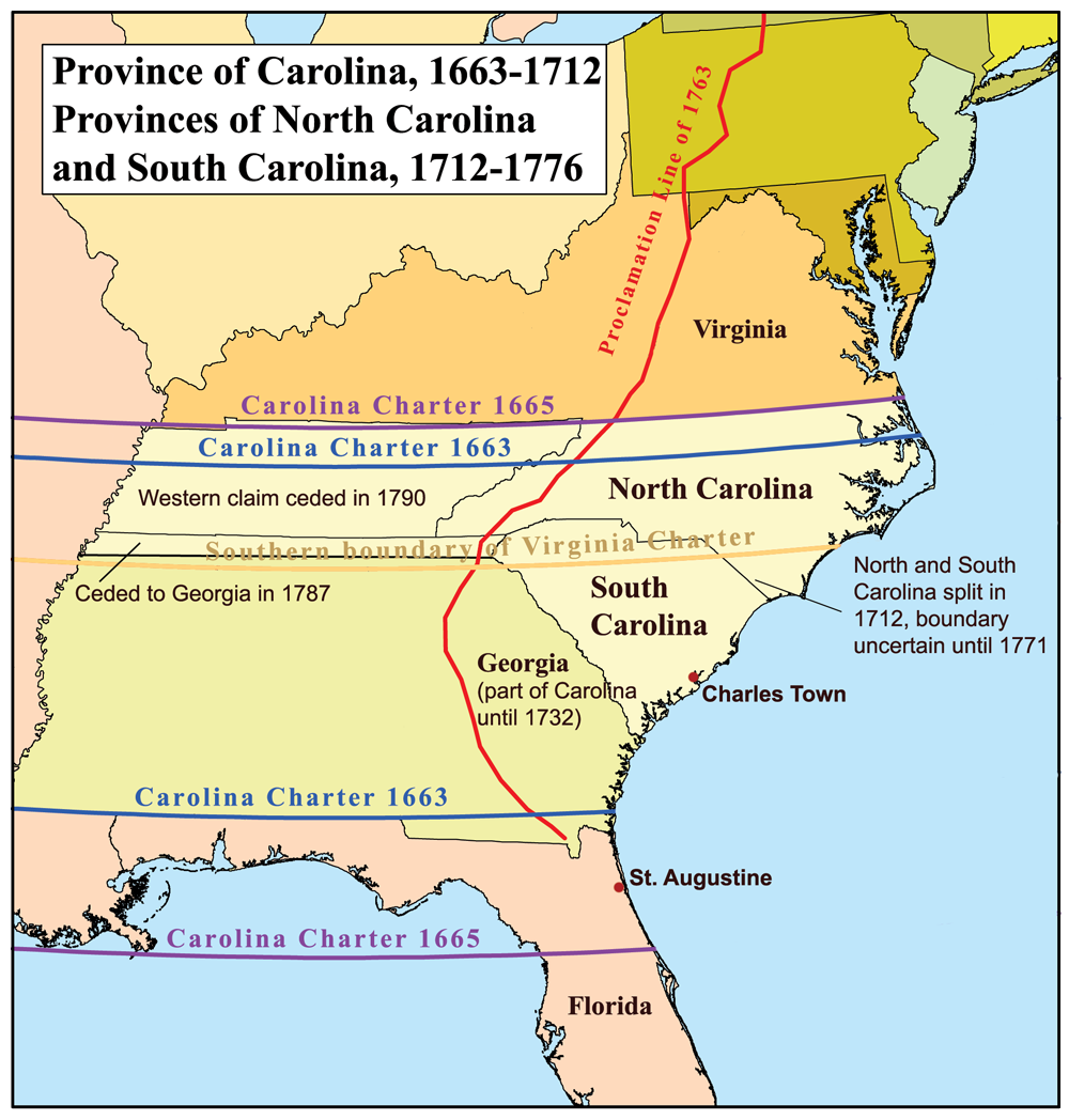
قالب:Svg This is a map of the Province of Carolina that I made. Boundary disputes between colonies not involving Carolina are not shown.
ترخيص
تاريخ الملف
اضغط على زمن/تاريخ لرؤية الملف كما بدا في هذا الزمن.
| زمن/تاريخ | صورة مصغرة | الأبعاد | مستخدم | تعليق | |
|---|---|---|---|---|---|
| حالي | ★ مراجعة معتمدة 20:08، 9 نوفمبر 2023 | | 1٬000 × 1٬048 (419 كيلوبايت) | Pastakhov (نقاش | مساهمات) | Upload https://upload.wikimedia.org/wikipedia/commons/e/e7/Carolinacolony.png |
لا يمكنك استبدال هذا الملف.
وصلات
لا يوجد صفحات تصل لهذه الصورة.
معلومات الصورة (ميتا)
تصنيفات:
- Self-published work
- Maps of disputed territories in North America
- Maps of the Thirteen Colonies
- Media missing infobox template
- Province of Carolina
- Maps of the history of colonies of the United Kingdom
- Maps of the history of North Carolina
- Maps of the history of South Carolina
- Maps of the history of Georgia (U.S. state)
- Royal Proclamation of 1763
- 1732 in Georgia (U.S. state)
- Province of Georgia
- Carolina Charter