ملف:Capefearrivermap.png
لا توجد دقة أعلى متوفرة.
Capefearrivermap.png (500 × 500 بكسل حجم الملف: 147 كيلوبايت، نوع MIME: image/png)
وصف قصير
| ⧼wm-license-information-description⧽ |
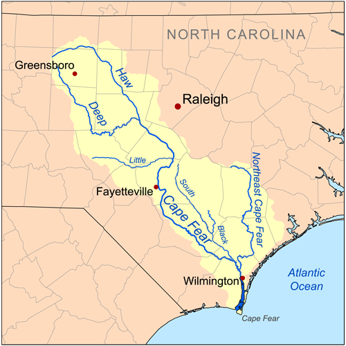
Map showing the Cape Fear River drainage basin. |
| ⧼wm-license-information-date⧽ | 2008 |
| ⧼wm-license-information-source⧽ | Self-made, based on USGS data. |
| ⧼wm-license-information-author⧽ | Kmusser |
|
تاريخ الملف
اضغط على زمن/تاريخ لرؤية الملف كما بدا في هذا الزمن.
| زمن/تاريخ | صورة مصغرة | الأبعاد | مستخدم | تعليق | |
|---|---|---|---|---|---|
| حالي | ★ مراجعة معتمدة 14:25، 15 يناير 2024 | | 500 × 500 (147 كيلوبايت) | Pastakhov (نقاش | مساهمات) | Upload https://upload.wikimedia.org/wikipedia/commons/e/e4/Capefearrivermap.png |
لا يمكنك استبدال هذا الملف.
وصلات
لا يوجد صفحات تصل لهذه الصورة.