ملف:Cape Kazantip, Kerch Peninsula, Southern Sea of Azov, Ukraine.JPG

حجم هذه المعاينة: 800 × 533 بكسل. البعدان الآخران: 2٬560 × 1٬705 بكسل | 6٬048 × 4٬028 بكسل.
الملف الأصلي (6٬048 × 4٬028 بكسل حجم الملف: 3٫96 ميجابايت، نوع MIME: image/jpeg)
وصف قصير
| ⧼wm-license-information-description⧽ |
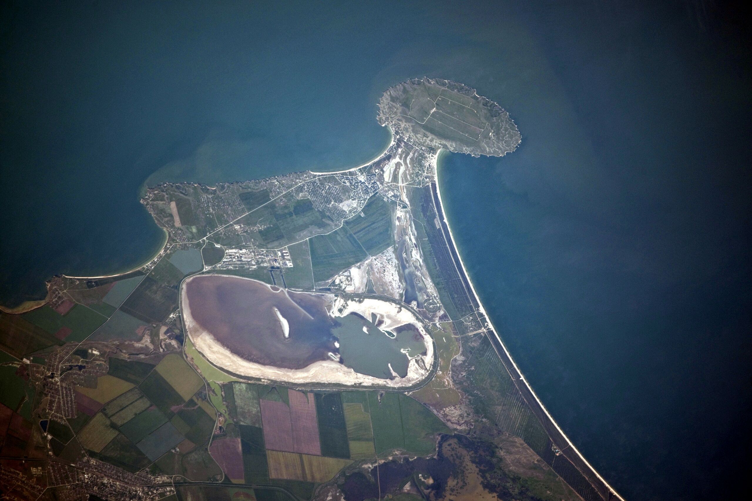
English: Cape Kazantip is a prominent headland on the Kerch Peninsula, which defines the southern shore of the Sea of Azov and the east extension of the Crimean Peninsula. During the Second World War, German and Soviet forces fought on the Kerch Peninsula, with the line of battle impinging on areas shown at the bottom of the image. The distance from the tip of the Cape to the largest local city, Lenine (population ~70,000, image lower left) is only 20 kilometres.
Français : A l'est de la péninsule de Crimée, Cap Kazantip est un promontoire sur la péninsule de Kertch, sur la rive sud de la mer d'Azov. Pendant la Seconde Guerre mondiale, les forces allemandes et soviétiques se sont battus sur la péninsule de Kertch. De la pointe du Cap à plus grande ville locale, Lenine (population ~ 70 000), il y a 20 kilomètres. Une centrale nucléaire en construction a été suspendue en 1989, suite à la chute du bloc soviétique.
|
| ⧼wm-license-information-date⧽ | 2010 |
| ⧼wm-license-information-source⧽ | NASA Earth Observatory |
| ⧼wm-license-information-author⧽ | ISS Expedition 23 crew |
45°24′0.0″N 35°48′00.0″E / 45.400000°N 35.800000°E قالب:NASA-image This detailed astronaut photograph was taken from the International Space Station (ISS) when it was located 400 kilometres to the north-east, but due to the long (800 mm) lens used, the photo includes detailed field patterns and city blocks. Green and brown fields show intensive agricultural activity in the area, and salt ponds are visible at the west end of the shallow Lake Aktashskoye at image centre.
ترخيص
تاريخ الملف
اضغط على زمن/تاريخ لرؤية الملف كما بدا في هذا الزمن.
| زمن/تاريخ | صورة مصغرة | الأبعاد | مستخدم | تعليق | |
|---|---|---|---|---|---|
| حالي | ★ مراجعة معتمدة 17:11، 13 نوفمبر 2023 | | 6٬048 × 4٬028 (3٫96 ميجابايت) | Pastakhov (نقاش | مساهمات) | Upload https://upload.wikimedia.org/wikipedia/commons/1/15/Cape_Kazantip%2C_Kerch_Peninsula%2C_Southern_Sea_of_Azov%2C_Ukraine.JPG |
لا يمكنك استبدال هذا الملف.
وصلات
لا يوجد صفحات تصل لهذه الصورة.