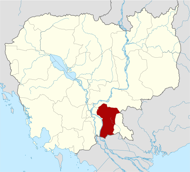
ملف:Cambodia Prey Veng locator map.svg

حجم معاينة PNG لذلك الملف ذي الامتداد SVG: 664 × 600 بكسل. البعد الآخر: 2٬267 × 2٬048 بكسل.
الملف الأصلي (ملف SVG، أبعاده 1٬347 × 1٬217 بكسل، حجم الملف: 734 كيلوبايت)
قالب:Igen
| ⧼wm-license-information-description⧽ |
Deutsch: Positionskarte von Kambodscha Quadratische Plattkarte, N-S-Streckung 105 %. Geographische Begrenzung der Karte: * N: 14.8° N * S: 9.9° N * W: 102.2° O * O: 107.9° O Equirectangular projection, N/S stretching 105 %. Geographic limits of the map: * N: 14.8° N * S: 9.9° N * W: 102.2° E * E: 107.9° E
|
| ⧼wm-license-information-date⧽ | 2010-02-02 14:37 (UTC) |
| ⧼wm-license-information-source⧽ | قالب:Based |
| ⧼wm-license-information-author⧽ | Kmusser |
| [This is a retouched picture, which means that it has been digitally altered from its original version. Modifications: highlighted Prey Veng Province. The original can be viewed here: Cambodia_location_map.svg. Modifications made by Kmusser.] Error: {{Lang}}: text has italic markup (help)
|
|

قالب:Original upload log
This image is a derivative work of the following images:
- File:Cambodia_location_map.svg licensed with Cc-by-sa-3.0, GFDL
- 2009-02-12T21:35:03Z NordNordWest 1347x1217 (728478 Bytes) smaller file
- 2009-02-12T20:56:36Z NordNordWest 1347x1216 (1074945 Bytes) {{Information |Description= {{de|Positionskarte von [[:de:Kambodscha|Kambodscha]]}} Quadratische Plattkarte, N-S-Streckung 105 %. Geographische Begrenzung der Karte: * N: 14.8° N * S: 9.9° N * W: 102.2° O * O: 107.9° O {{
تاريخ الملف
اضغط على زمن/تاريخ لرؤية الملف كما بدا في هذا الزمن.
| زمن/تاريخ | صورة مصغرة | الأبعاد | مستخدم | تعليق | |
|---|---|---|---|---|---|
| حالي | ★ مراجعة معتمدة 14:41، 14 أكتوبر 2023 | | 1٬347 × 1٬217 (734 كيلوبايت) | Pastakhov (نقاش | مساهمات) | Upload https://upload.wikimedia.org/wikipedia/commons/8/80/Cambodia_Prey_Veng_locator_map.svg |
لا يمكنك استبدال هذا الملف.
وصلات
لا يوجد صفحات تصل لهذه الصورة.