ملف:Cēsu novads 2021.png
حجم هذه المعاينة: 762 × 599 بكسل. البعد الآخر: 1٬822 × 1٬433 بكسل.
الملف الأصلي (1٬822 × 1٬433 بكسل حجم الملف: 842 كيلوبايت، نوع MIME: image/png)
وصف قصير
| ⧼wm-license-information-description⧽ |
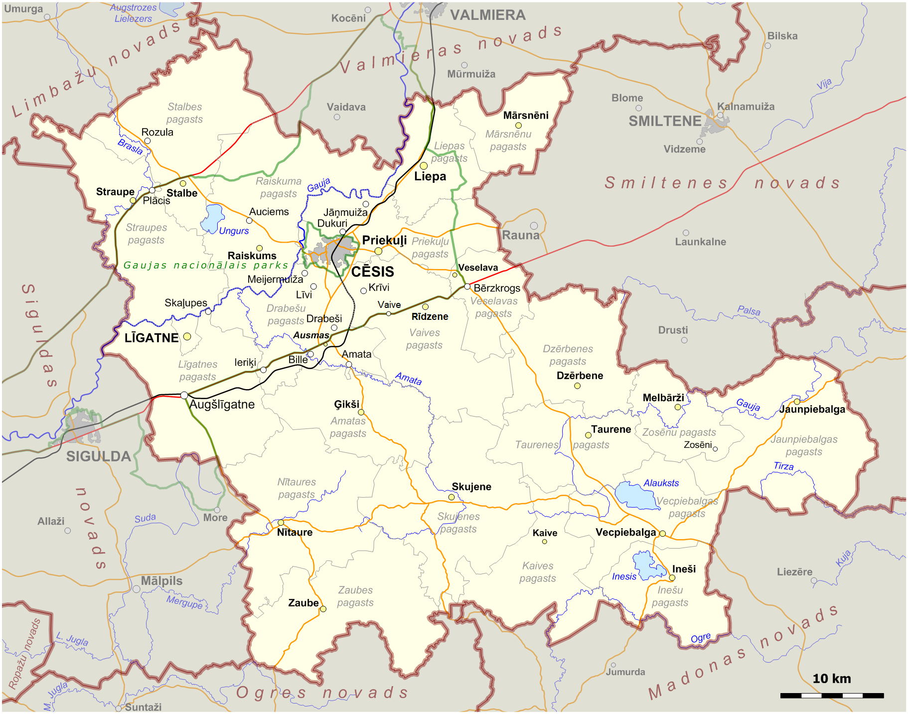
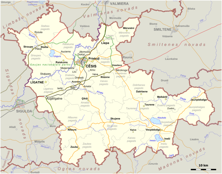
English: Map of Cēsis Municipality in Latvia. The borders of municipalities as of 1 July 2021.
|
| ⧼wm-license-information-date⧽ | 2021 |
| ⧼wm-license-information-source⧽ | ⧼Wm-license-own-work⧽. The map was created using OpenStreetMap data. The borders of administrative divisions based on the Law On Administrative Territories and Populated Areas of 10 June 2020. The size of populated places according to Geographical Names Database. |
| ⧼wm-license-information-author⧽ | Obivan Kenobi |
ترخيص
|
تاريخ الملف
اضغط على زمن/تاريخ لرؤية الملف كما بدا في هذا الزمن.
| زمن/تاريخ | صورة مصغرة | الأبعاد | مستخدم | تعليق | |
|---|---|---|---|---|---|
| حالي | ★ مراجعة معتمدة 01:05، 26 ديسمبر 2023 | | 1٬822 × 1٬433 (842 كيلوبايت) | Pastakhov (نقاش | مساهمات) | Upload https://upload.wikimedia.org/wikipedia/commons/8/87/C%C4%93su_novads_2021.png |
لا يمكنك استبدال هذا الملف.
وصلات
لا يوجد صفحات تصل لهذه الصورة.