ملف:Bulgaria Tvarditsa Municipality geographic map bg.svg

حجم معاينة PNG لذلك الملف ذي الامتداد SVG: 681 × 600 بكسل. البعد الآخر: 2٬325 × 2٬048 بكسل.
الملف الأصلي (ملف SVG، أبعاده 1٬135 × 1٬000 بكسل، حجم الملف: 3٫26 ميجابايت)
وصف قصير
| ⧼wm-license-information-description⧽ |
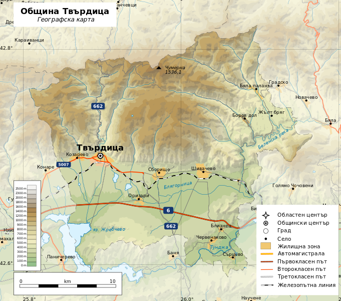
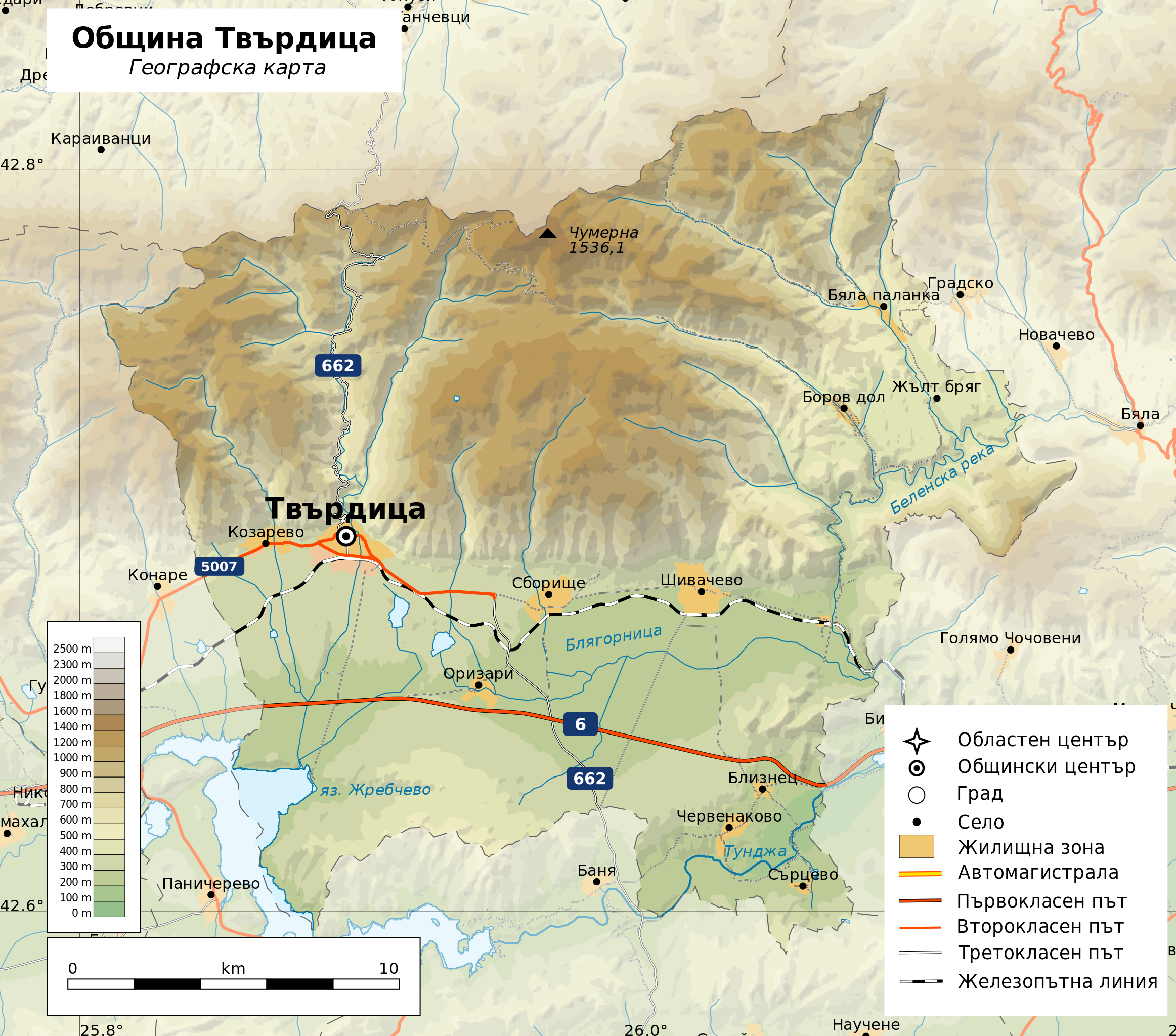
English: Geographic map of Tvarditsa Municipality, Bulgaria in Bulgarian. Geographic limits of the map:
Projection: Equidistant Cylindrical |
| ⧼wm-license-information-date⧽ | 2017 |
| ⧼wm-license-information-source⧽ | ⧼Wm-license-own-work⧽
|
| ⧼wm-license-information-author⧽ | Ikonact |
| ⧼wm-license-information-permission⧽ (⧼wm-license-information-permission-reusing-text⧽) |
Any use of this map is subject of the license(s) stated below with the condition that you credit (Wikimedia Commons user: Ikonact) as the author . A message with a reply address would also be greatly appreciated. |
قالب:Translation possible قالب:Atelier graphique carte قالب:Inkscape-hand
ترخيص
|
تاريخ الملف
اضغط على زمن/تاريخ لرؤية الملف كما بدا في هذا الزمن.
| زمن/تاريخ | صورة مصغرة | الأبعاد | مستخدم | تعليق | |
|---|---|---|---|---|---|
| حالي | ★ مراجعة معتمدة 22:15، 8 نوفمبر 2023 | | 1٬135 × 1٬000 (3٫26 ميجابايت) | Pastakhov (نقاش | مساهمات) | Upload https://upload.wikimedia.org/wikipedia/commons/e/ea/Bulgaria_Tvarditsa_Municipality_geographic_map_bg.svg |
لا يمكنك استبدال هذا الملف.
وصلات
لا يوجد صفحات تصل لهذه الصورة.