ملف:Bulgaria-Kraishte-topographic-map-bg.svg

حجم معاينة PNG لذلك الملف ذي الامتداد SVG: 607 × 600 بكسل. البعد الآخر: 2٬074 × 2٬048 بكسل.
الملف الأصلي (ملف SVG، أبعاده 2٬835 × 2٬800 بكسل، حجم الملف: 8٫98 ميجابايت)
وصف قصير
| ⧼wm-license-information-description⧽ |
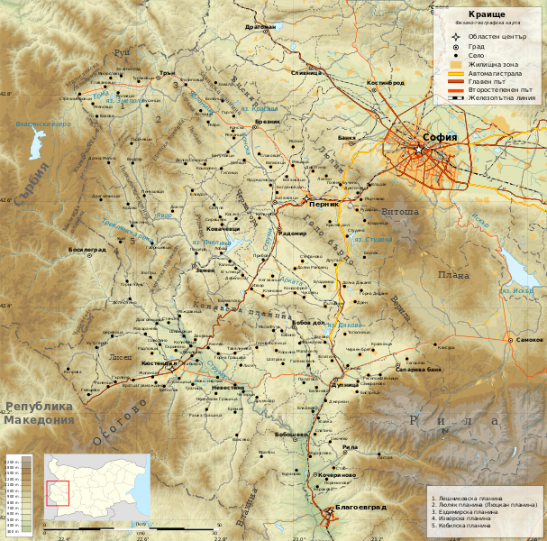
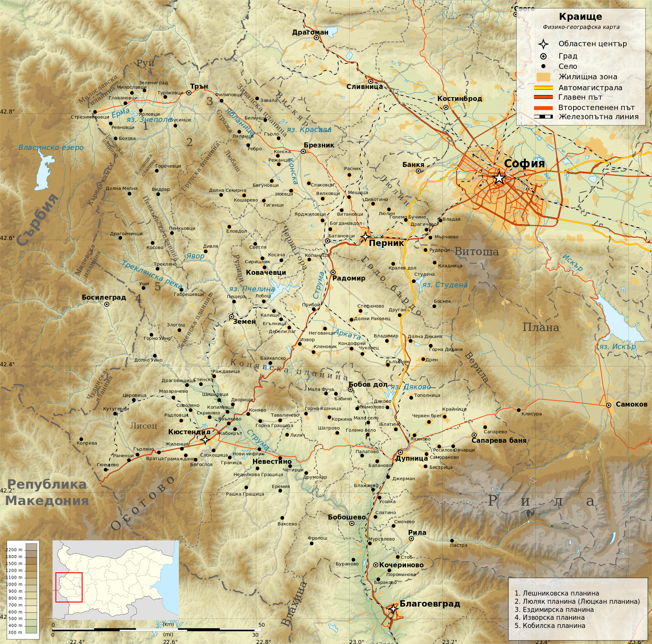
English: Geographic map of Kraishte region in Bulgaria in Bulgarian. Geographic limits of the map:
Projection: Equidistant Cylindrical |
| ⧼wm-license-information-date⧽ | 2013, {{time}} – invalid date format 05 (help) |
| ⧼wm-license-information-source⧽ | ⧼Wm-license-own-work⧽
|
| ⧼wm-license-information-author⧽ | Ikonact |
ترخيص
|
تاريخ الملف
اضغط على زمن/تاريخ لرؤية الملف كما بدا في هذا الزمن.
| زمن/تاريخ | صورة مصغرة | الأبعاد | مستخدم | تعليق | |
|---|---|---|---|---|---|
| حالي | ★ مراجعة معتمدة 15:08، 17 نوفمبر 2023 | | 2٬835 × 2٬800 (8٫98 ميجابايت) | Pastakhov (نقاش | مساهمات) | Upload https://upload.wikimedia.org/wikipedia/commons/5/52/Bulgaria-Kraishte-topographic-map-bg.svg |
لا يمكنك استبدال هذا الملف.
وصلات
لا يوجد صفحات تصل لهذه الصورة.