ملف:Broadland UK locator map.svg

حجم معاينة PNG لذلك الملف ذي الامتداد SVG: 800 × 497 بكسل. البعد الآخر: 2٬560 × 1٬592 بكسل.
الملف الأصلي (ملف SVG، أبعاده 1٬425 × 886 بكسل، حجم الملف: 1٫14 ميجابايت)
| ⧼wm-license-information-description⧽ |
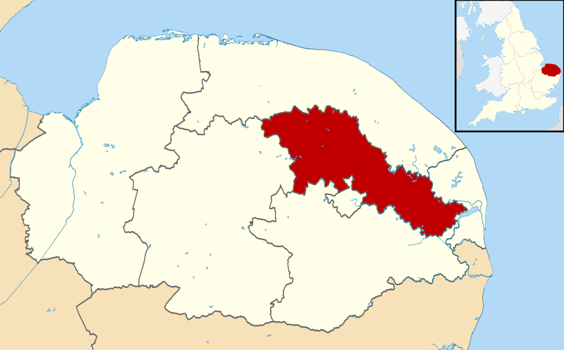
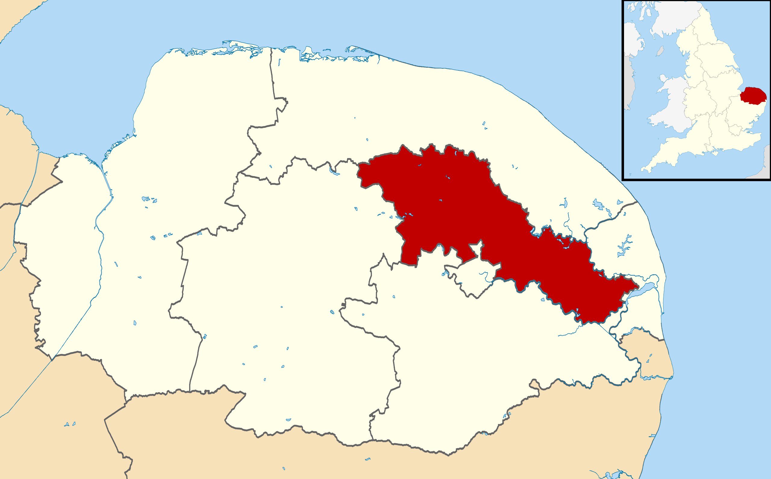
Map of Norfolk, with Broadland highlighted. |
| ⧼wm-license-information-date⧽ | 2011-07-31 23:02 (UTC) |
| ⧼wm-license-information-source⧽ | |
| ⧼wm-license-information-author⧽ |
|
.svg&action=edit&redlink=1)
|
قالب:Original upload log
This image is a derivative work of the following images:
- File:Norfolk_UK_district_map_(blank).svg licensed with Cc-by-sa-3.0
- 2010-08-22T08:14:53Z Nilfanion 1425x886 (1188582 Bytes) +inset, water colour tweak
- 2010-07-16T23:44:46Z Nilfanion 1425x992 (822544 Bytes) {{Information |Description=Map of [[w:Norfolk|Norfolk]], UK with districts shown. Equirectangular map projection on WGS 84 datum, with N/S stretched 160% Geographic limits: *West: 0.12E *East: 1.80E *North: 53.05N *South: 5
تاريخ الملف
اضغط على زمن/تاريخ لرؤية الملف كما بدا في هذا الزمن.
| زمن/تاريخ | صورة مصغرة | الأبعاد | مستخدم | تعليق | |
|---|---|---|---|---|---|
| حالي | ★ مراجعة معتمدة 05:33، 25 أكتوبر 2023 | | 1٬425 × 886 (1٫14 ميجابايت) | Pastakhov (نقاش | مساهمات) | Upload https://upload.wikimedia.org/wikipedia/commons/4/49/Broadland_UK_locator_map.svg |
لا يمكنك استبدال هذا الملف.
وصلات
لا يوجد صفحات تصل لهذه الصورة.