ملف:Britain.Anglo.Saxon.homelands.settlements.400.500.jpg
حجم هذه المعاينة: 531 × 599 بكسل. البعد الآخر: 2٬100 × 2٬369 بكسل.
الملف الأصلي (2٬100 × 2٬369 بكسل حجم الملف: 783 كيلوبايت، نوع MIME: image/jpeg)
| ⧼wm-license-information-description⧽ |
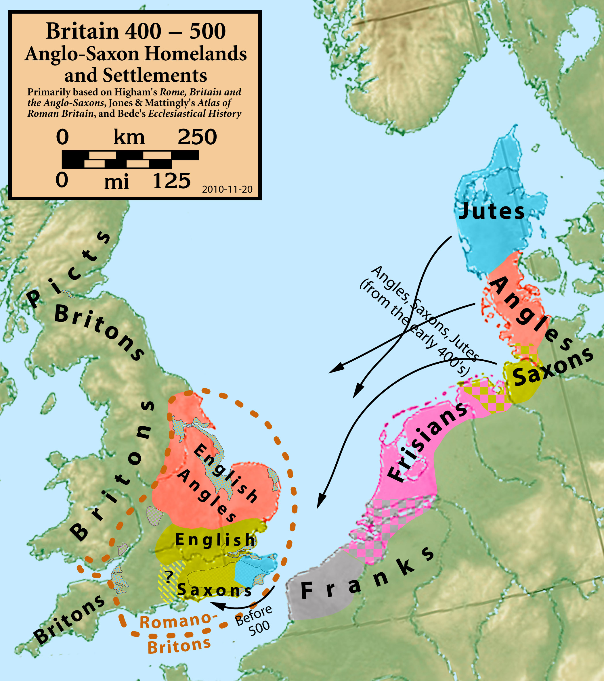
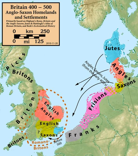
Britain 400–500: Anglo-Saxon Homelands and Settlements |
| ⧼wm-license-information-date⧽ | 2010 |
| ⧼wm-license-information-source⧽ | Primarily based on Bede's Ecclesiastical History (Book I, Chapter 15), giving Angle, Saxon, and Jute homelands; Jones & Mattingly's Atlas of Roman Britain (ISBN 978-1-84217-06700, 1990, reprinted 2007); and Higham's Rome, Britain and the Anglo-Saxons (ISBN 1-85264-022-7, 1992). Sources are cited in the title box.
|
| ⧼wm-license-information-author⧽ | my work |
|
تاريخ الملف
اضغط على زمن/تاريخ لرؤية الملف كما بدا في هذا الزمن.
| زمن/تاريخ | صورة مصغرة | الأبعاد | مستخدم | تعليق | |
|---|---|---|---|---|---|
| حالي | ★ مراجعة معتمدة 17:29، 25 يناير 2024 | | 2٬100 × 2٬369 (783 كيلوبايت) | Pastakhov (نقاش | مساهمات) | Upload https://upload.wikimedia.org/wikipedia/commons/5/53/Britain.Anglo.Saxon.homelands.settlements.400.500.jpg |
لا يمكنك استبدال هذا الملف.
وصلات
لا يوجد صفحات تصل لهذه الصورة.