ملف:Bracadale church - geograph.org.uk - 1191836.jpg
لا توجد دقة أعلى متوفرة.
Bracadale_church_-_geograph.org.uk_-_1191836.jpg (640 × 480 بكسل حجم الملف: 137 كيلوبايت، نوع MIME: image/jpeg)
وصف قصير
| ⧼wm-license-information-description⧽ |
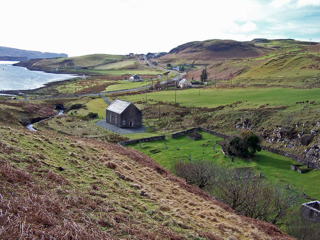
English: Bracadale church The ancient burial ground on the right contains the site of St Assind's Church. In front of it is the Bracadale Free Presbyterian Church.
The road in the picture is the A863 from Sligachan to Dunvegan. The water on the left is Loch Beag. |
| ⧼wm-license-information-date⧽ | 2009 |
| ⧼wm-license-information-source⧽ | From geograph.org.uk |
| ⧼wm-license-information-author⧽ | Richard Dorrell |
| ⧼wm-license-cc-attribution⧽ (قالب:I18n/Credit line) |
Richard Dorrell / Bracadale church / |
57°21′48″N 6°23′51″W / 57.36329°N 6.3974°W قالب:Object location
_heading:225)
ترخيص
تاريخ الملف
اضغط على زمن/تاريخ لرؤية الملف كما بدا في هذا الزمن.
| زمن/تاريخ | صورة مصغرة | الأبعاد | مستخدم | تعليق | |
|---|---|---|---|---|---|
| حالي | ★ مراجعة معتمدة 08:36، 4 نوفمبر 2023 | | 640 × 480 (137 كيلوبايت) | Pastakhov (نقاش | مساهمات) | Upload https://upload.wikimedia.org/wikipedia/commons/7/76/Bracadale_church_-_geograph.org.uk_-_1191836.jpg |
لا يمكنك استبدال هذا الملف.
وصلات
لا يوجد صفحات تصل لهذه الصورة.