ملف:Bogotá - aerial view - Country Club.jpg
حجم هذه المعاينة: 800 × 507 بكسل. البعد الآخر: 1٬024 × 649 بكسل.
الملف الأصلي (1٬024 × 649 بكسل حجم الملف: 637 كيلوبايت، نوع MIME: image/jpeg)
وصف قصير
| ⧼wm-license-information-description⧽ |
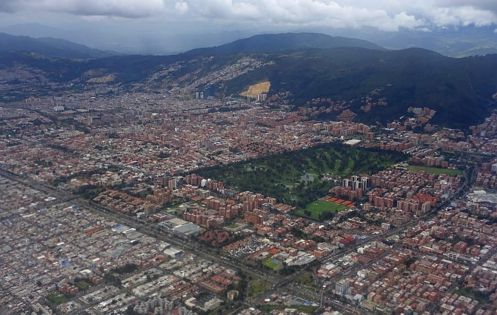
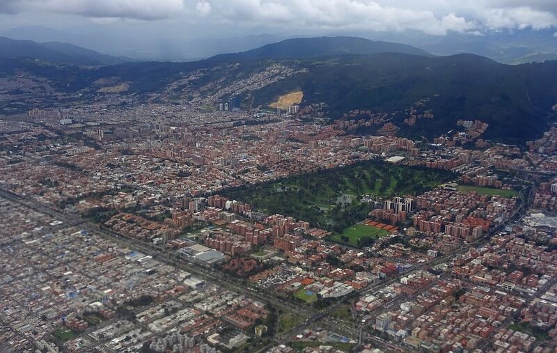
English: Aerial view of northern Bogotá; Country Club, Calle 127, Autopista Norte, Calle 134, Eastern Hills
|
| ⧼wm-license-information-date⧽ | 2016 |
| ⧼wm-license-information-source⧽ | ⧼Wm-license-own-work⧽ |
| ⧼wm-license-information-author⧽ | Tisquesusa |
04°42′27″N 74°03′34″W / 4.70750°N 74.05944°W
ترخيص
تاريخ الملف
اضغط على زمن/تاريخ لرؤية الملف كما بدا في هذا الزمن.
| زمن/تاريخ | صورة مصغرة | الأبعاد | مستخدم | تعليق | |
|---|---|---|---|---|---|
| حالي | ★ مراجعة معتمدة 16:23، 27 أكتوبر 2023 | | 1٬024 × 649 (637 كيلوبايت) | Pastakhov (نقاش | مساهمات) | Upload https://upload.wikimedia.org/wikipedia/commons/4/4e/Bogot%C3%A1_-_aerial_view_-_Country_Club.jpg |
لا يمكنك استبدال هذا الملف.
وصلات
لا يوجد صفحات تصل لهذه الصورة.