ملف:Boötes constellation map ru lite.png
الملف الأصلي (2٬100 × 2٬100 بكسل حجم الملف: 137 كيلوبايت، نوع MIME: image/png)
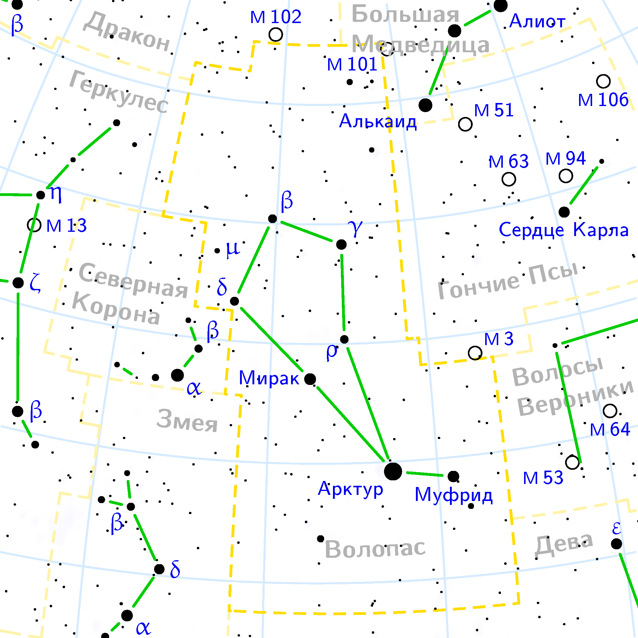
Boötes constellation map on Russian / Карта созвездия Волопаса на русском языке
Copyright © 2003 Denis Ibaev.
It was created by Denis Ibaev using the program PP3 on 2nd March 2005. At PP3's homepage, you also get the input scripts necessary for re-compiling the map.
The yellow dashed lines are constellation boundaries, the red dashed line is the ecliptic, and the shades of blue show Milky Way areas of different brightness. The map contains all Messier objects, except for colliding ones. The underlying database contains all stars brighter than 6.5. All coordinates refer to equinox 2000.0.
The map is calculated with the equidistant azimuthal projection (the zenith being in the center of the image). The north pole is to the top. The (horizontal) lines of equal declination are drawn for 0°, +10°, +20° etc. The lines of equal rectascension are drawn for all 24 hours. Towards the rim there is a very slight magnification (and distortion).

|
تاريخ الملف
اضغط على زمن/تاريخ لرؤية الملف كما بدا في هذا الزمن.
| زمن/تاريخ | صورة مصغرة | الأبعاد | مستخدم | تعليق | |
|---|---|---|---|---|---|
| حالي | ★ مراجعة معتمدة 03:52، 21 أكتوبر 2023 | | 2٬100 × 2٬100 (137 كيلوبايت) | Pastakhov (نقاش | مساهمات) | Upload https://upload.wikimedia.org/wikipedia/commons/5/5f/Bo%C3%B6tes_constellation_map_ru_lite.png |
لا يمكنك استبدال هذا الملف.
وصلات
لا يوجد صفحات تصل لهذه الصورة.