ملف:BlueLine-ar.jpg
حجم هذه المعاينة: 800 × 553 بكسل. البعد الآخر: 1٬024 × 708 بكسل.
الملف الأصلي (1٬024 × 708 بكسل حجم الملف: 226 كيلوبايت، نوع MIME: image/jpeg)
وصف قصير
| ⧼wm-license-information-description⧽ |
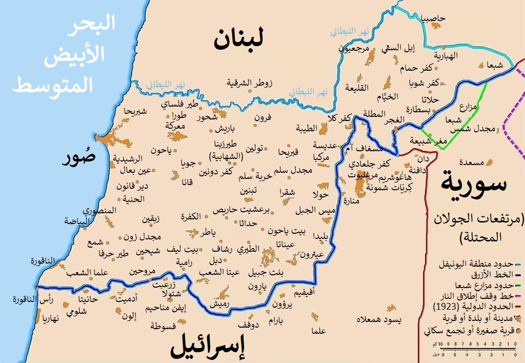
العربية: خريطة توضح الخط الأزرق الفاصل بين لبنان وإسرائيل ، الذي أنشأته الأمم المتحدة بعد الانسحاب الإسرائيلي من جنوب لبنان بعد غزوها القصير عام 1978 والذي أطلق عليه عملية الليطاني. يتبع خط وقف إطلاق النار لعام 1949 ، المعروف أيضًا باسم الخط الأخضر، بالإضافة إلى الحدود اللبنانية السورية المتنازع عليها تجاه مرتفعات الجولان التي تحتلها إسرائيل.
English: Map showing the Blue Line demarcation line between Lebanon and Israel, established by the UN after the Israeli withdrawal from southern Lebanon after its short 1978 invasion called Operation Litani. It follows the 1949 cease-fire line, also known as the Green Line, as well as the somewhat contested Lebanese-Syrian border towards the Israeli-occupied Golan Heights.
|
| ⧼wm-license-information-date⧽ | 2021 |
| ⧼wm-license-information-source⧽ | قالب:Derived from |
| ⧼wm-license-information-author⧽ | صانع:Michel Bakni |
| ⧼wm-license-information-other-versions⧽ |
|

| [This is a retouched picture, which means that it has been digitally altered from its original version. Modifications: قالب:Langswitch. The original can be viewed here: BlueLine.jpg. Modifications made by Michel Bakni.] Error: {{Lang}}: text has italic markup (help)
|
ترخيص
|
تاريخ الملف
اضغط على زمن/تاريخ لرؤية الملف كما بدا في هذا الزمن.
| زمن/تاريخ | صورة مصغرة | الأبعاد | مستخدم | تعليق | |
|---|---|---|---|---|---|
| حالي | ★ مراجعة معتمدة 19:36، 18 أكتوبر 2023 | | 1٬024 × 708 (226 كيلوبايت) | Pastakhov (نقاش | مساهمات) | Upload https://upload.wikimedia.org/wikipedia/commons/9/94/BlueLine-ar.jpg |
لا يمكنك استبدال هذا الملف.
وصلات
لا يوجد صفحات تصل لهذه الصورة.