ملف:Berlin - Olympiagelände und Murellenberge.png

حجم هذه المعاينة: 800 × 541 بكسل. البعد الآخر: 1٬261 × 853 بكسل.
الملف الأصلي (1٬261 × 853 بكسل حجم الملف: 660 كيلوبايت، نوع MIME: image/png)
وصف قصير
| ⧼wm-license-information-description⧽ |
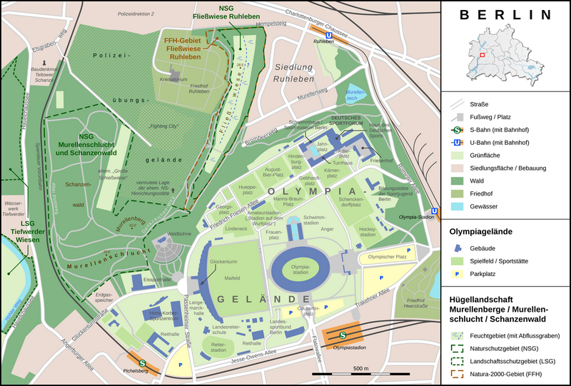
English: Map of the Olympic grounds of Berlin and the adjacent nature reserves
Deutsch: Lageplan des Berliner Olympiageländes und der angrenzenden Hügellandschaft der Murellenberge
|
| ⧼wm-license-information-date⧽ | 2012 |
| ⧼wm-license-information-source⧽ | ⧼Wm-license-own-work⧽
Sources: |
| ⧼wm-license-information-author⧽ | Thoroe |
| ⧼wm-license-information-permission⧽ (⧼wm-license-information-permission-reusing-text⧽) |
قالب:Object location قالب:Kartenwerkstatt
ترخيص
|
|
هذا الملفُّ مُرخَّص بموجب رخصة المشاع الإبداعي نسبة المُصنَّف إِلى مؤلفه - المشاركة بالمثل 3.0 العامة. |
تاريخ الملف
اضغط على زمن/تاريخ لرؤية الملف كما بدا في هذا الزمن.
| زمن/تاريخ | صورة مصغرة | الأبعاد | مستخدم | تعليق | |
|---|---|---|---|---|---|
| حالي | ★ مراجعة معتمدة 22:43، 30 أكتوبر 2023 | | 1٬261 × 853 (660 كيلوبايت) | Pastakhov (نقاش | مساهمات) | Upload https://upload.wikimedia.org/wikipedia/commons/f/f5/Berlin_-_Olympiagel%C3%A4nde_und_Murellenberge.png |
لا يمكنك استبدال هذا الملف.
وصلات
لا يوجد صفحات تصل لهذه الصورة.