ملف:Bercy limites communales 1859.png

حجم هذه المعاينة: 753 × 599 بكسل. البعدان الآخران: 2٬560 × 2٬038 بكسل | 3٬683 × 2٬932 بكسل.
الملف الأصلي (3٬683 × 2٬932 بكسل حجم الملف: 13٫86 ميجابايت، نوع MIME: image/png)
وصف قصير
| ⧼wm-license-information-description⧽ |
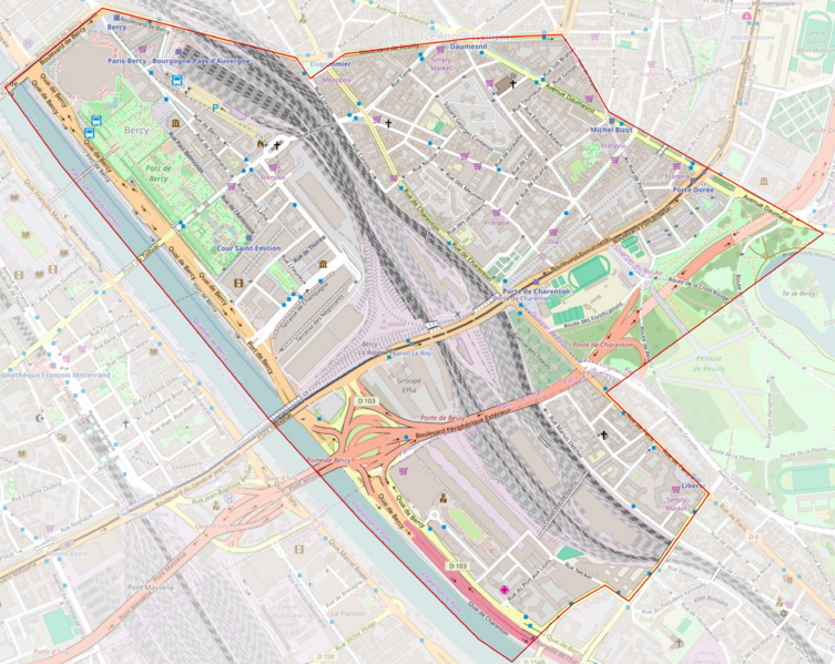
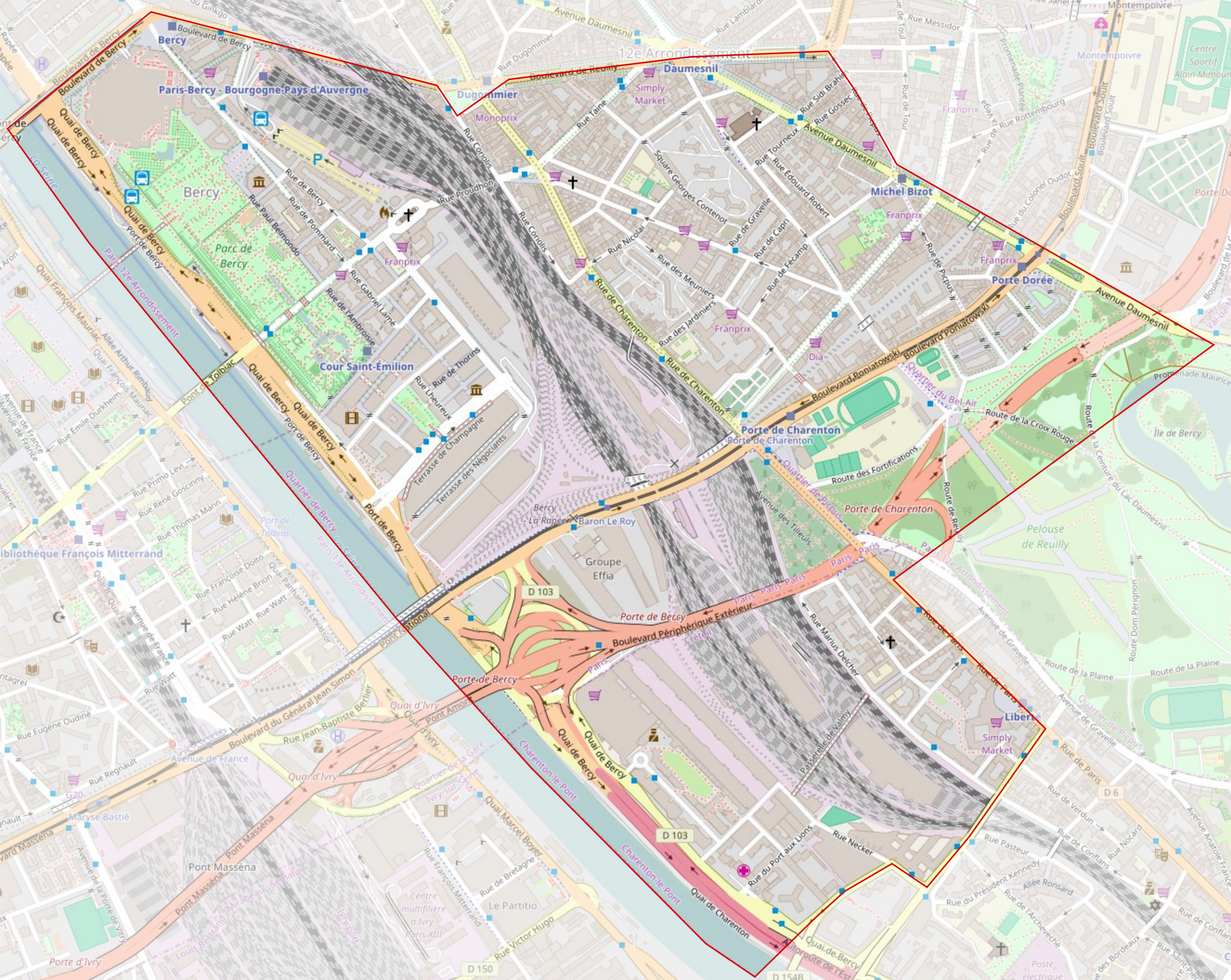
Français : Limites de l'ancienne commune de Bercy, avant son annexion à Paris en 1859, reportées sur un plan moderne.
|
| ⧼wm-license-information-date⧽ | 2016 |
| ⧼wm-license-information-source⧽ | ⧼Wm-license-own-work⧽ |
| ⧼wm-license-information-author⧽ | Karldupart قالب:OpenStreetMap |
ترخيص
|
تاريخ الملف
اضغط على زمن/تاريخ لرؤية الملف كما بدا في هذا الزمن.
| زمن/تاريخ | صورة مصغرة | الأبعاد | مستخدم | تعليق | |
|---|---|---|---|---|---|
| حالي | ★ مراجعة معتمدة 14:12، 13 أكتوبر 2023 | | 3٬683 × 2٬932 (13٫86 ميجابايت) | Pastakhov (نقاش | مساهمات) | Upload https://upload.wikimedia.org/wikipedia/commons/f/f4/Bercy_limites_communales_1859.png |
لا يمكنك استبدال هذا الملف.
وصلات
لا يوجد صفحات تصل لهذه الصورة.