ملف:Belgian Medieval Dioceses.png
حجم هذه المعاينة: 437 × 600 بكسل. البعد الآخر: 1٬664 × 2٬284 بكسل.
الملف الأصلي (1٬664 × 2٬284 بكسل حجم الملف: 140 كيلوبايت، نوع MIME: image/png)
وصف قصير
قالب:Uploaded with en.wp UW marker
| ⧼wm-license-information-description⧽ |
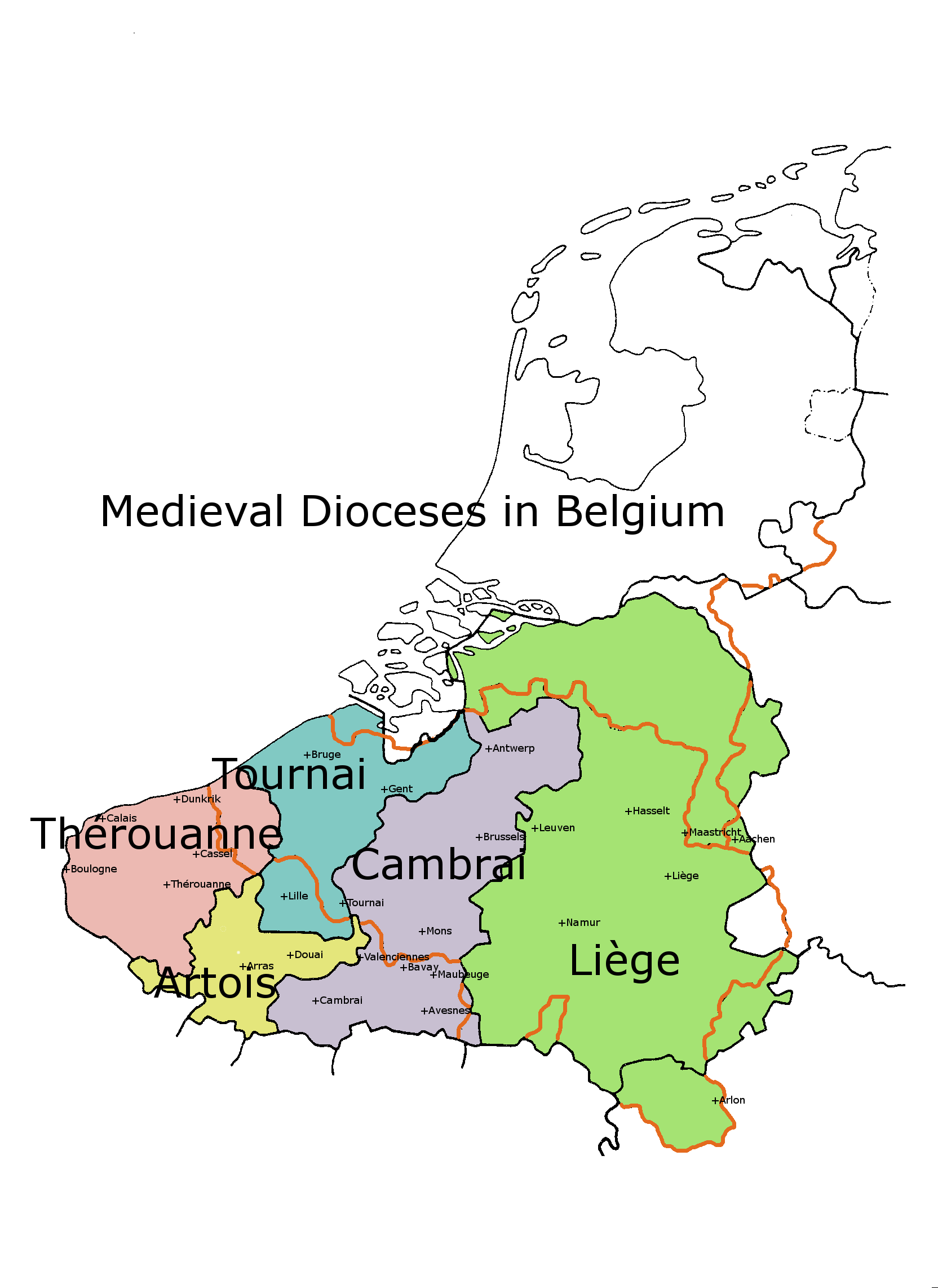
English: This is a map showing the old Catholic dioceses, which were to some extent based upon ancient Roman and pre-Roman territories.
|
| ⧼wm-license-information-date⧽ | 2013 |
| ⧼wm-license-information-source⧽ | Using Gimp software Previously published: Various old Belgian books, Kleine atlas voor de geschiedenis van beide Limburgen. J.H.M. Wieland, page 15 Kerkelijke indeling van de Nederlanden |
| ⧼wm-license-information-author⧽ | Andrew Lancaster |
| ⧼wm-license-information-other-versions⧽ |
Dutch translation: File:Low Countries Medieval Dioceses-NL.png |
ترخيص
|

تاريخ الملف
اضغط على زمن/تاريخ لرؤية الملف كما بدا في هذا الزمن.
| زمن/تاريخ | صورة مصغرة | الأبعاد | مستخدم | تعليق | |
|---|---|---|---|---|---|
| حالي | ★ مراجعة معتمدة 19:26، 1 ديسمبر 2023 | | 1٬664 × 2٬284 (140 كيلوبايت) | Pastakhov (نقاش | مساهمات) | Upload https://upload.wikimedia.org/wikipedia/commons/b/b3/Belgian_Medieval_Dioceses.png |
لا يمكنك استبدال هذا الملف.
وصلات
لا يوجد صفحات تصل لهذه الصورة.