ملف:Belfast Aerial.jpg
حجم هذه المعاينة: 450 × 600 بكسل. البعد الآخر: 1٬944 × 2٬592 بكسل.
الملف الأصلي (1٬944 × 2٬592 بكسل حجم الملف: 1٫68 ميجابايت، نوع MIME: image/jpeg)
وصف قصير
| ⧼wm-license-information-description⧽ |
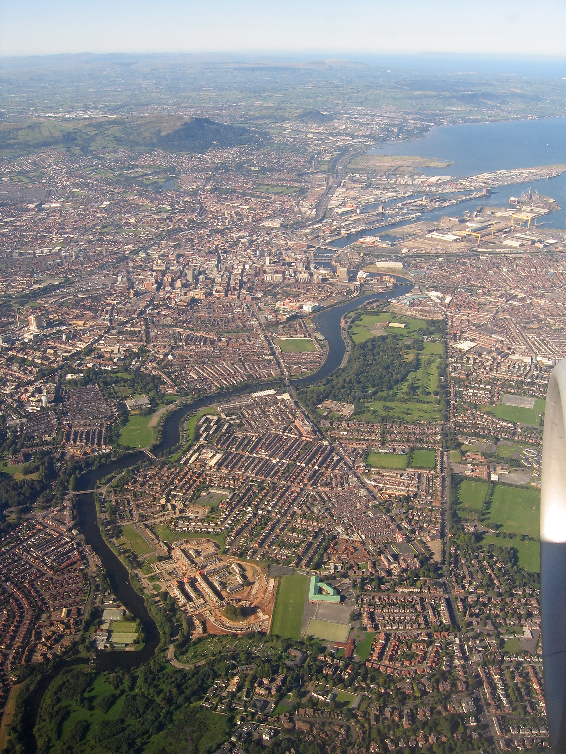
English: Aerial photo of south-east, central and north Belfast, taken from a plane on a clear evening, 9th September 2004. Includes the River Lagan, Stranmillis, Annadale Embankment, Ormeau Road, Ravenhill Road, Ormeau Park, City Hospital, parts of east and west Belfast, Belfast Docks, Mallusk, Cave Hill, Carnmoney Hill and extends to the Glens of Antrim, Causeway Coast and the coast of Scotland in the distance.
|
| ⧼wm-license-information-date⧽ | 2004, {{time}} – invalid date format 52 (help) |
| ⧼wm-license-information-source⧽ | ⧼Wm-license-own-work⧽ |
| ⧼wm-license-information-author⧽ | Fattonyni |
| ⧼wm-license-information-other-versions⧽ |
54°33′55.1″N 5°55′05.8″W / 54.565306°N 5.918278°W
ترخيص
|
تاريخ الملف
اضغط على زمن/تاريخ لرؤية الملف كما بدا في هذا الزمن.
| زمن/تاريخ | صورة مصغرة | الأبعاد | مستخدم | تعليق | |
|---|---|---|---|---|---|
| حالي | ★ مراجعة معتمدة 07:48، 3 نوفمبر 2023 | | 1٬944 × 2٬592 (1٫68 ميجابايت) | Pastakhov (نقاش | مساهمات) | Upload https://upload.wikimedia.org/wikipedia/commons/b/bd/Belfast_Aerial.jpg |
لا يمكنك استبدال هذا الملف.
وصلات
لا يوجد صفحات تصل لهذه الصورة.