ملف:Battle of the Somme 1916 map.png
حجم هذه المعاينة: 363 × 599 بكسل. البعد الآخر: 600 × 990 بكسل.
الملف الأصلي (600 × 990 بكسل حجم الملف: 63 كيلوبايت، نوع MIME: image/png)
وصف قصير
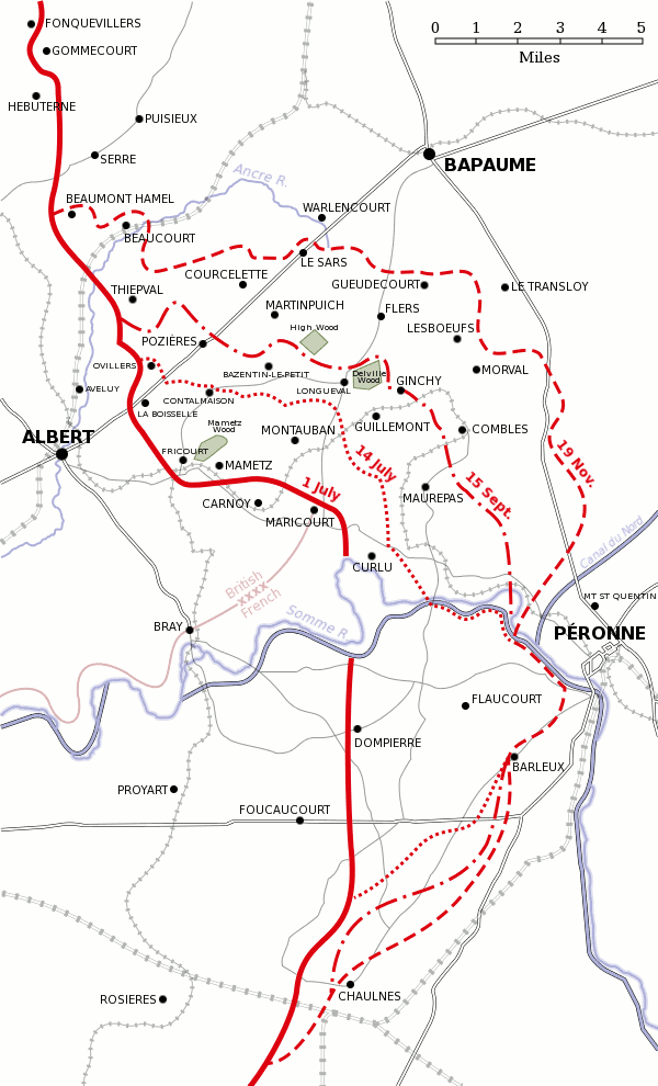
Español: Progreso de la Batalla del Somme entre el 1 de julio y el 18 de noviembre de 1916.
Map of the Somme battlefield, 1916, showing the frontline before the three major offensives of 1 & 14 July and 15 September as well as the final frontline at the end of the battle of 18 November..
Based on a map from A Short Military History of World War I - Atlas, edited by T. Dodson Stamps and Vincent J. Esposito, 1950.
derivative works
تاريخ الملف
اضغط على زمن/تاريخ لرؤية الملف كما بدا في هذا الزمن.
| زمن/تاريخ | صورة مصغرة | الأبعاد | مستخدم | تعليق | |
|---|---|---|---|---|---|
| حالي | ★ مراجعة معتمدة 18:09، 10 نوفمبر 2023 | | 600 × 990 (63 كيلوبايت) | Pastakhov (نقاش | مساهمات) | Upload https://upload.wikimedia.org/wikipedia/commons/4/42/Battle_of_the_Somme_1916_map.png |
لا يمكنك استبدال هذا الملف.
وصلات
لا يوجد صفحات تصل لهذه الصورة.