ملف:Battle of Tadmur.svg

حجم معاينة PNG لذلك الملف ذي الامتداد SVG: 800 × 415 بكسل. البعد الآخر: 2٬560 × 1٬329 بكسل.
الملف الأصلي (ملف SVG، أبعاده 863 × 448 بكسل، حجم الملف: 544 كيلوبايت)
وصف قصير
| ⧼wm-license-information-description⧽ |
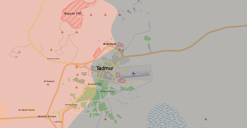
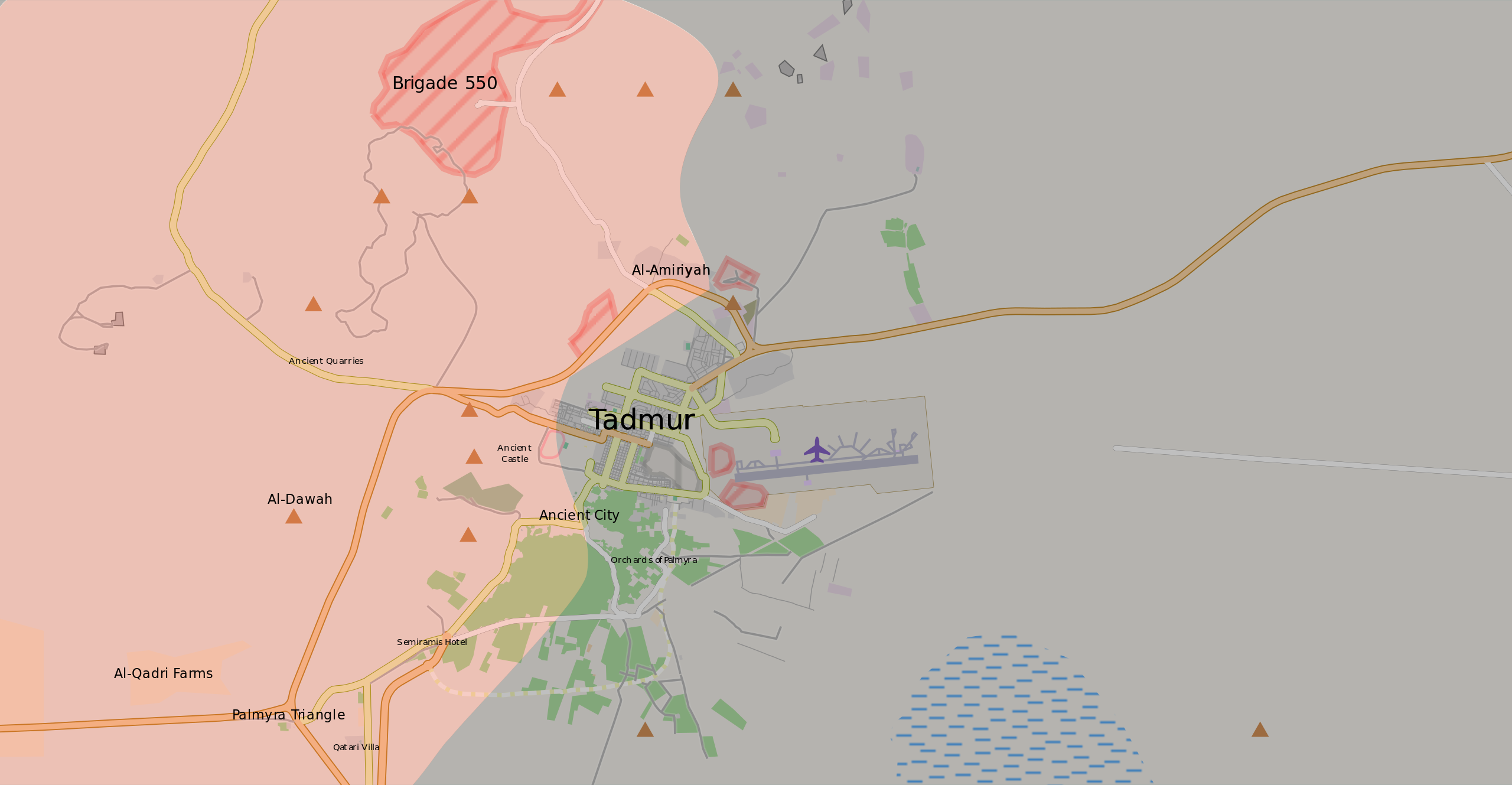
Tadmur (Arabic: تدمر; ancient Palmyra, Homs Governorate). Map of the current situation during the Palmyra offensive (March 2016). After updating this map, please also update the date(s) at w:Module:Iraq Syria map date, used to denote the date in articles. Controlled by the Syrian Armed Forces
Controlled by the Islamic State of Iraq and the Levant
The disputed frontline between the forces
|
| ⧼wm-license-information-date⧽ | 2016 |
| ⧼wm-license-information-source⧽ | ⧼Wm-license-own-work⧽ |
| ⧼wm-license-information-author⧽ | Bolter21 |
| ⧼wm-license-information-other-versions⧽ |
قالب:Ongoing civil wars (maps)قالب:City maps of ongoing civil wars |
ترخيص
|
تاريخ الملف
اضغط على زمن/تاريخ لرؤية الملف كما بدا في هذا الزمن.
| زمن/تاريخ | صورة مصغرة | الأبعاد | مستخدم | تعليق | |
|---|---|---|---|---|---|
| حالي | ★ مراجعة معتمدة 20:31، 4 نوفمبر 2023 | | 863 × 448 (544 كيلوبايت) | Pastakhov (نقاش | مساهمات) | Upload https://upload.wikimedia.org/wikipedia/commons/0/04/Battle_of_Tadmur.svg |
لا يمكنك استبدال هذا الملف.
وصلات
لا يوجد صفحات تصل لهذه الصورة.