ملف:Bassingbourn village sign - geograph.org.uk - 1349350.jpg
حجم هذه المعاينة: 450 × 600 بكسل. البعد الآخر: 480 × 640 بكسل.
الملف الأصلي (480 × 640 بكسل حجم الملف: 99 كيلوبايت، نوع MIME: image/jpeg)
وصف قصير
| ⧼wm-license-information-description⧽ |
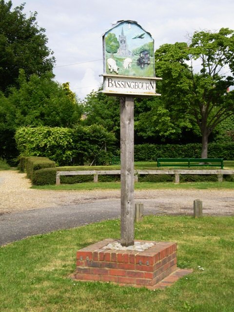
English: Bassingbourn village sign The sign depicts the connection of the village with the airfield (now Bassingbourn Barracks), with pig farming and with the manufacture of the first London taxis.
|
| ⧼wm-license-information-date⧽ | 2009 |
| ⧼wm-license-information-source⧽ | From geograph.org.uk |
| ⧼wm-license-information-author⧽ | Mike W Hallett |
| ⧼wm-license-cc-attribution⧽ (قالب:I18n/Credit line) |
Mike W Hallett / Bassingbourn village sign / |
52°04′42″N 0°03′14″W / 52.07833°N 0.0539°W قالب:Object location
_heading:67)
ترخيص
تاريخ الملف
اضغط على زمن/تاريخ لرؤية الملف كما بدا في هذا الزمن.
| زمن/تاريخ | صورة مصغرة | الأبعاد | مستخدم | تعليق | |
|---|---|---|---|---|---|
| حالي | ★ مراجعة معتمدة 19:06، 23 أكتوبر 2023 | | 480 × 640 (99 كيلوبايت) | Pastakhov (نقاش | مساهمات) | Upload https://upload.wikimedia.org/wikipedia/commons/6/69/Bassingbourn_village_sign_-_geograph.org.uk_-_1349350.jpg |
لا يمكنك استبدال هذا الملف.
وصلات
لا يوجد صفحات تصل لهذه الصورة.