ملف:Bassin de la Canche.svg

حجم معاينة PNG لذلك الملف ذي الامتداد SVG: 800 × 561 بكسل. البعد الآخر: 2٬560 × 1٬794 بكسل.
الملف الأصلي (ملف SVG، أبعاده 1٬457 × 1٬021 بكسل، حجم الملف: 1٫87 ميجابايت)
وصف قصير
| ⧼wm-license-information-description⧽ |
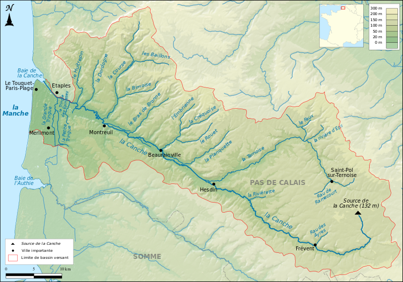
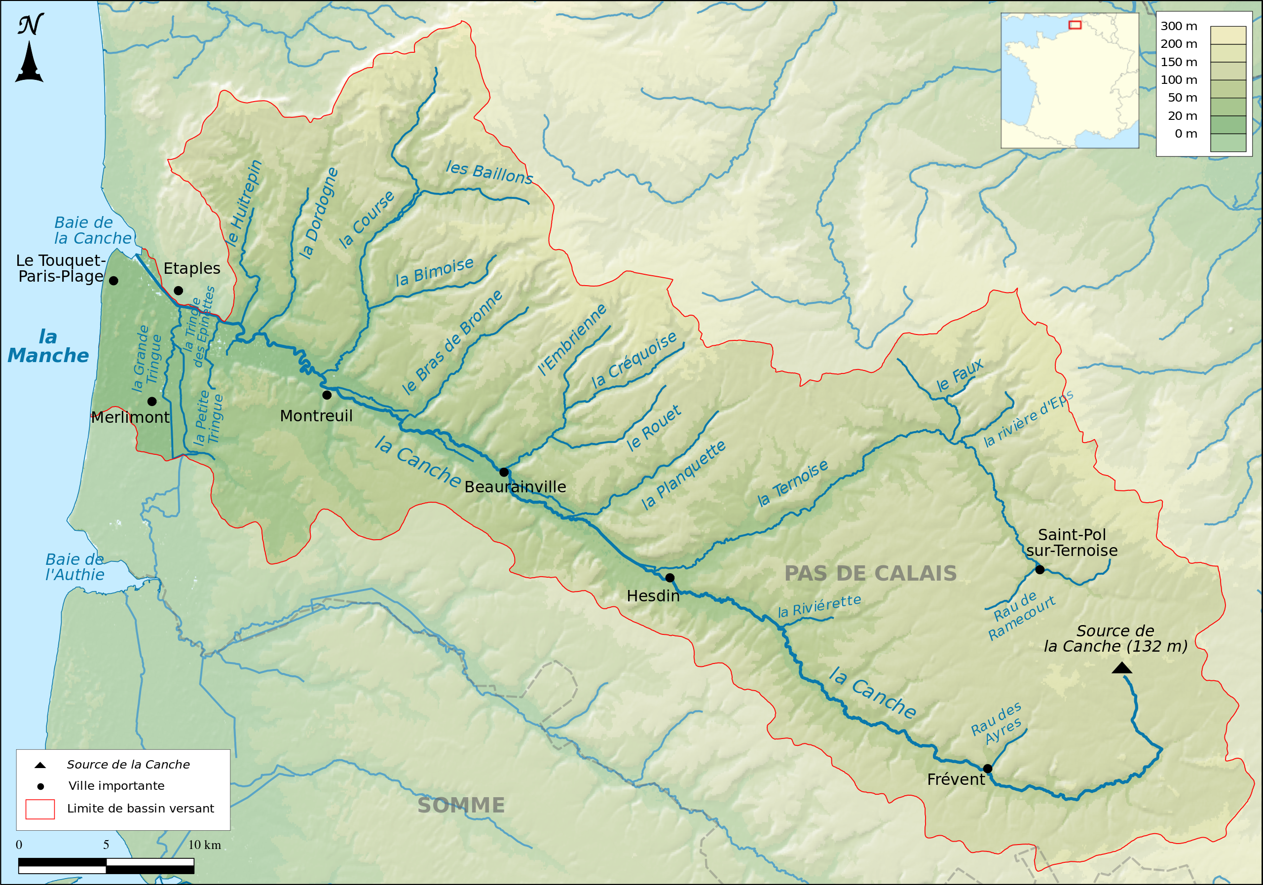
Français : Carte topographique du Bassin de la Canche
|
| ⧼wm-license-information-date⧽ | 2016 |
| ⧼wm-license-information-source⧽ | ⧼Wm-license-own-work⧽
Relief : SRTM3v2 Hydrographie : BD Carthage® Minicarte : Blank map of Europe par Historicair Projection : Lambert 93 |
| ⧼wm-license-information-author⧽ | Boldair |
ترخيص
|
تاريخ الملف
اضغط على زمن/تاريخ لرؤية الملف كما بدا في هذا الزمن.
| زمن/تاريخ | صورة مصغرة | الأبعاد | مستخدم | تعليق | |
|---|---|---|---|---|---|
| حالي | ★ مراجعة معتمدة 18:08، 7 ديسمبر 2023 | | 1٬457 × 1٬021 (1٫87 ميجابايت) | Pastakhov (نقاش | مساهمات) | Upload https://upload.wikimedia.org/wikipedia/commons/c/ce/Bassin_de_la_Canche.svg |
لا يمكنك استبدال هذا الملف.
وصلات
لا يوجد صفحات تصل لهذه الصورة.