ملف:Barry Burn - geograph.org.uk - 1658664.jpg
لا توجد دقة أعلى متوفرة.
Barry_Burn_-_geograph.org.uk_-_1658664.jpg (640 × 480 بكسل حجم الملف: 97 كيلوبايت، نوع MIME: image/jpeg)
وصف قصير
| ⧼wm-license-information-description⧽ |
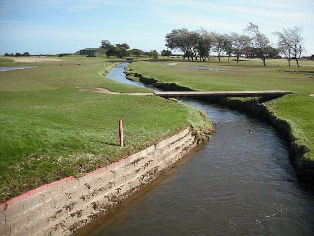
English: Barry Burn The Barry Burn crossing the golf courses on Carnoustie Links. A few days previously it had flooded a lot of the surrounding land, and there was still some surface water and debris on some of the fairways.
|
| ⧼wm-license-information-date⧽ | 2009 |
| ⧼wm-license-information-source⧽ | From geograph.org.uk |
| ⧼wm-license-information-author⧽ | Richard Webb |
| ⧼wm-license-cc-attribution⧽ (قالب:I18n/Credit line) |
Richard Webb / Barry Burn / |
56°29′42″N 2°44′02″W / 56.49488°N 2.7339°W قالب:Object location
_heading:112)
ترخيص
تاريخ الملف
اضغط على زمن/تاريخ لرؤية الملف كما بدا في هذا الزمن.
| زمن/تاريخ | صورة مصغرة | الأبعاد | مستخدم | تعليق | |
|---|---|---|---|---|---|
| حالي | ★ مراجعة معتمدة 00:06، 3 نوفمبر 2023 | | 640 × 480 (97 كيلوبايت) | Pastakhov (نقاش | مساهمات) | Upload https://upload.wikimedia.org/wikipedia/commons/5/57/Barry_Burn_-_geograph.org.uk_-_1658664.jpg |
لا يمكنك استبدال هذا الملف.
وصلات
لا يوجد صفحات تصل لهذه الصورة.