ملف:Balungao,PangasinanHalljf6365 17.JPG
حجم هذه المعاينة: 800 × 600 بكسل. البعدان الآخران: 2٬560 × 1٬920 بكسل | 4٬608 × 3٬456 بكسل.
الملف الأصلي (4٬608 × 3٬456 بكسل حجم الملف: 6٫06 ميجابايت، نوع MIME: image/jpeg)
وصف قصير
| ⧼wm-license-information-description⧽ |
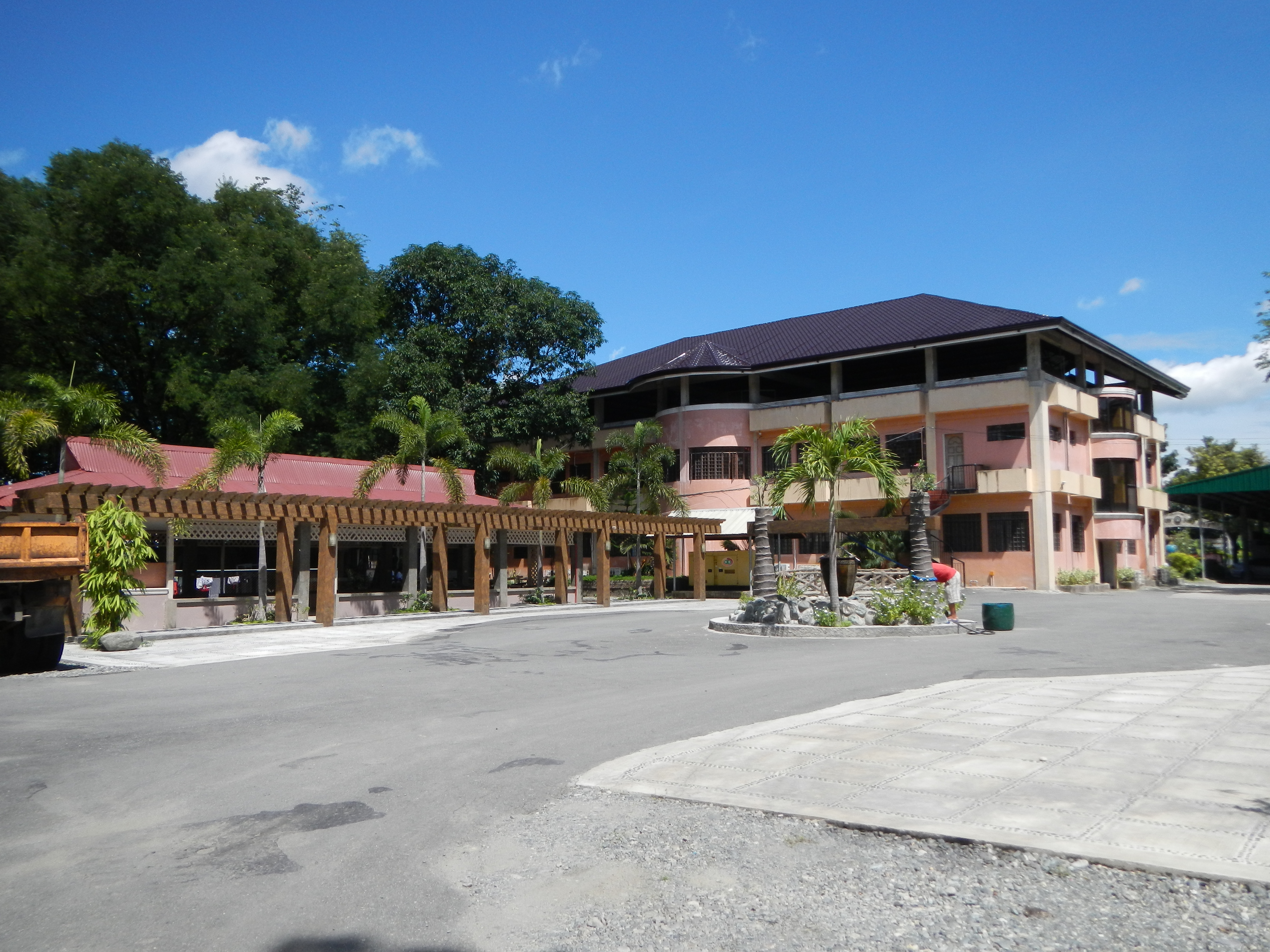
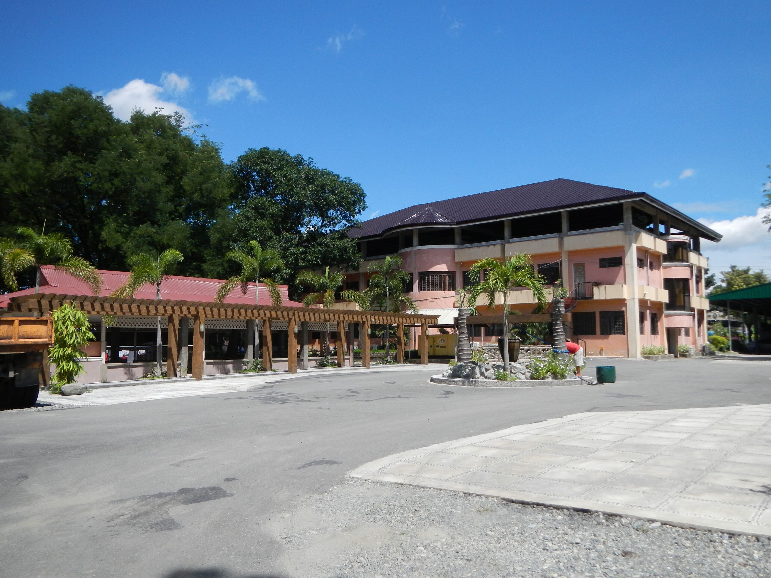
English: UploadWizard photos of Municipal Town Hall of Balungao, Pangasinan [1] Coordinates: 15°53'52"N 120°40'18"E [2] & Balungao Town Plaza & ParkCoordinates: 15°53'56"N 120°40'19"E [3] [4] Balungao Hilltop Adventure which has the longest ZipLine in Region I it has a length of 600 meters.
[5] [6] Town Proper - is a municipality in the province of Pangasinan[7] in the Philippines subdivided into 20 barangays) [8] [9] Land Area: 73.25 km² ZIP Code: 2442 Coordinates: 15°53'10"N 120°42'7"E Mt. Balungao Hot & Cold Springs Resort [10] [11] [12] Mount Balungao [13] ([14] (15°51′44.90″N 120°40′57.70″E) is an extinct volcano[15], 382 metres (1,253 ft) ASL located in Balungao. Its volcanic past is manifested by its physical profile and the presence of hot and cold springs. The Philippine Institute of Volcanology and Seismology (PHIVOLCS)[16] lists Mount Balungao as an inactive volcano.[17] Coordinates: 15°51'47"N 120°40'54"E [18] [19] it is 383 meters high and has both hot and cold springs; one of only two found in Pangasinan (Mt Manleluag Spring National Park in Mangatarem). [20]
|
| ⧼wm-license-information-date⧽ | 2013, {{time}} – invalid date format 58 (help) |
| ⧼wm-license-information-source⧽ | ⧼Wm-license-own-work⧽ |
| ⧼wm-license-information-author⧽ | Ramon FVelasquez |
ترخيص
|
تاريخ الملف
اضغط على زمن/تاريخ لرؤية الملف كما بدا في هذا الزمن.
| زمن/تاريخ | صورة مصغرة | الأبعاد | مستخدم | تعليق | |
|---|---|---|---|---|---|
| حالي | ★ مراجعة معتمدة 14:35، 18 أكتوبر 2023 | | 4٬608 × 3٬456 (6٫06 ميجابايت) | Pastakhov (نقاش | مساهمات) | Upload https://upload.wikimedia.org/wikipedia/commons/5/50/Balungao%2CPangasinanHalljf6365_17.JPG |
لا يمكنك استبدال هذا الملف.
وصلات
لا يوجد صفحات تصل لهذه الصورة.