ملف:Baarle-Hertog Antwerp Belgium Map.svg

حجم معاينة PNG لذلك الملف ذي الامتداد SVG: 798 × 600 بكسل. البعد الآخر: 2٬560 × 1٬925 بكسل.
الملف الأصلي (ملف SVG، أبعاده 987 × 742 بكسل، حجم الملف: 2٫85 ميجابايت)
وصف قصير
| ⧼wm-license-information-description⧽ |
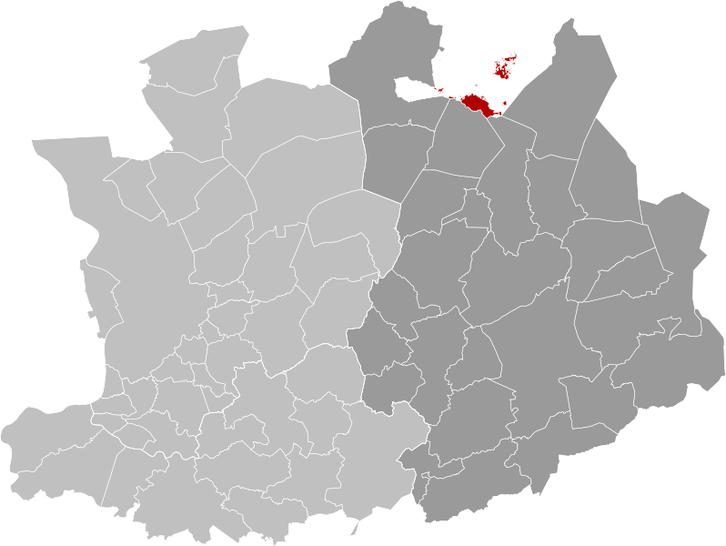
Français : Carte indiquant la localisation de la commune de Baerle-Duc en rouge dans son arrondissement et la province d'Anvers.
English: Map of Baarle-Hertog in province of Antwerp, Belgium.
|
| ⧼wm-license-information-date⧽ | 2019 |
| ⧼wm-license-information-source⧽ | ⧼Wm-license-own-work⧽ |
| ⧼wm-license-information-author⧽ | OD02fr |
ترخيص
|
تاريخ الملف
اضغط على زمن/تاريخ لرؤية الملف كما بدا في هذا الزمن.
| زمن/تاريخ | صورة مصغرة | الأبعاد | مستخدم | تعليق | |
|---|---|---|---|---|---|
| حالي | ★ مراجعة معتمدة 22:57، 20 أكتوبر 2023 | | 987 × 742 (2٫85 ميجابايت) | Pastakhov (نقاش | مساهمات) | Upload https://upload.wikimedia.org/wikipedia/commons/1/19/Baarle-Hertog_Antwerp_Belgium_Map.svg |
لا يمكنك استبدال هذا الملف.
وصلات
الصفحات التالية تحتوي على وصلة لهذه الصورة: