ملف:AxeHandleBridge.JPG

حجم هذه المعاينة: 800 × 481 بكسل. البعد الآخر: 1٬215 × 730 بكسل.
الملف الأصلي (1٬215 × 730 بكسل حجم الملف: 137 كيلوبايت، نوع MIME: image/jpeg)
40°6′56.7″N 83°25′30.9″W / 40.115750°N 83.425250°W
| ⧼wm-license-information-description⧽ |
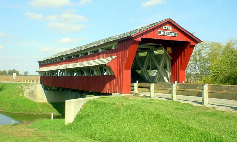
English: Southern portal of the Bigelow Covered Bridge, which carries Axe Handle Road over Little Darby Creek near Chuckery in Union Township, Union County, Ohio, United States. This Burr arch truss bridge was built in 1873.
|
|||
| ⧼wm-license-information-date⧽ | قالب:Taken on | |||
| ⧼wm-license-information-source⧽ | ⧼Wm-license-own-work⧽ (قالب:Original text) | |||
| ⧼wm-license-information-author⧽ | Adolphus79 (talk) | |||
| ⧼wm-license-information-permission⧽ (⧼wm-license-information-permission-reusing-text⧽) |
|
قالب:Original upload log
قالب:Transferred from قالب:Original description page
- 2010-01-18 21:03 Adolphus79 1215×730× (140384 bytes) Cropped...
- 2009-10-21 03:07 Adolphus79 1216×912× (154025 bytes) {{Information |Description=Bigelow Bridge, a [[covered bridge]] located near [[Chuckery, Ohio]], photographed October 11, 2009 by [[User:Adolphus79|Adolphus79]]. |Source=I created this work entirely by myself. |Date=October 11, 2009 |Author=[[User:Adolphu
تاريخ الملف
اضغط على زمن/تاريخ لرؤية الملف كما بدا في هذا الزمن.
| زمن/تاريخ | صورة مصغرة | الأبعاد | مستخدم | تعليق | |
|---|---|---|---|---|---|
| حالي | ★ مراجعة معتمدة 03:54، 9 نوفمبر 2023 | | 1٬215 × 730 (137 كيلوبايت) | Pastakhov (نقاش | مساهمات) | Upload https://upload.wikimedia.org/wikipedia/commons/a/ad/AxeHandleBridge.JPG |
لا يمكنك استبدال هذا الملف.
وصلات
لا يوجد صفحات تصل لهذه الصورة.