ملف:Auckland.arp.750pix.jpg
حجم هذه المعاينة: 694 × 599 بكسل. البعد الآخر: 1٬144 × 988 بكسل.
الملف الأصلي (1٬144 × 988 بكسل حجم الملف: 147 كيلوبايت، نوع MIME: image/jpeg)
وصف قصير
| ⧼wm-license-information-description⧽ |
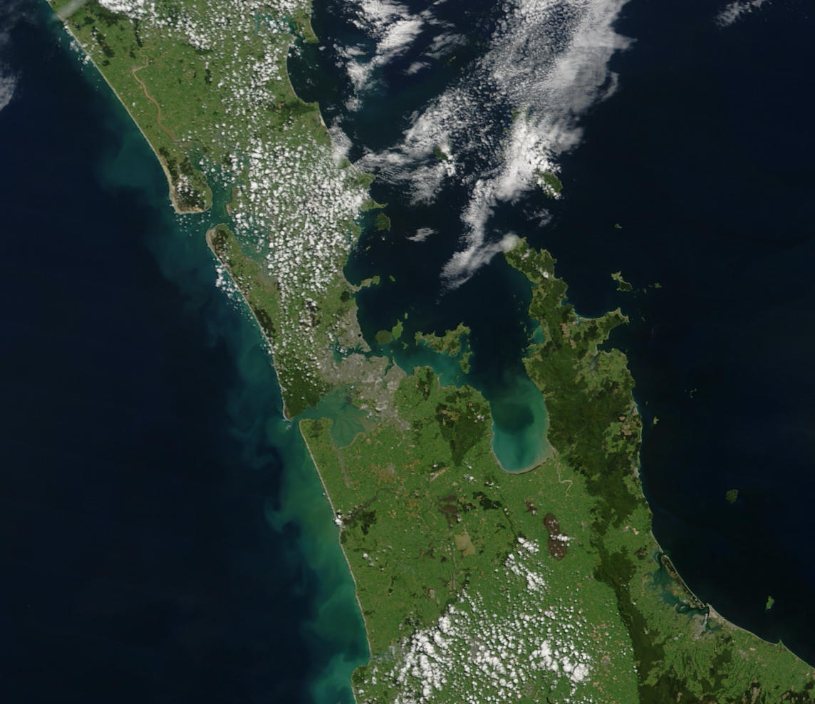
English: Auckland area, showing the base of the Northland Peninsula (top left), Auckland city (centre left), the Waikato plains (lower left), the Hauraki Gulf (centre), Coromandel Peninsula (right of centre), and the western Bay of Plenty and city of Tauranga (lower right).
"This stunning true-color image provides a rare, cloud-free look at the island nation of New Zealand, including most of its North and South Islands. This scene was acquired by the Moderate Resolution Imaging Spectroradiometer (MODIS), flying aboard NASA’s Terra satellite, on October 23, 2002. New Zealand is situated in the South Pacific Ocean, roughly 2,000 km (1,250 miles) southeast of Australia. Wellington, the capital of New Zealand, is located on the southern tip of the North Island, looking across Cook Strait toward South Island."
|
| ⧼wm-license-information-date⧽ | قالب:Taken on |
| ⧼wm-license-information-source⧽ | https://lance-modis.eosdis.nasa.gov/cgi-bin/imagery/single.cgi?image=NewZealand.A2002296.2220.250m.jpg (image link); see also https://earthobservatory.nasa.gov/images/3101/new-zealand and https://visibleearth.nasa.gov/view.php?id=62892 |
| ⧼wm-license-information-author⧽ | NASA/GSFC/MODIS Land Rapid Response Team, Jacques Descloitres |
| ⧼wm-license-information-other-versions⧽ |
ترخيص
تاريخ الملف
اضغط على زمن/تاريخ لرؤية الملف كما بدا في هذا الزمن.
| زمن/تاريخ | صورة مصغرة | الأبعاد | مستخدم | تعليق | |
|---|---|---|---|---|---|
| حالي | ★ مراجعة معتمدة 19:24، 25 أكتوبر 2023 | | 1٬144 × 988 (147 كيلوبايت) | Pastakhov (نقاش | مساهمات) | Upload https://upload.wikimedia.org/wikipedia/commons/d/d9/Auckland.arp.750pix.jpg |
لا يمكنك استبدال هذا الملف.
وصلات
لا يوجد صفحات تصل لهذه الصورة.