ملف:Athens Metro map (2007).svg

حجم معاينة PNG لذلك الملف ذي الامتداد SVG: 668 × 599 بكسل. البعد الآخر: 2٬282 × 2٬048 بكسل.
الملف الأصلي (ملف SVG، أبعاده 1٬560 × 1٬400 بكسل، حجم الملف: 661 كيلوبايت)
وصف قصير
| ⧼wm-license-information-description⧽ |
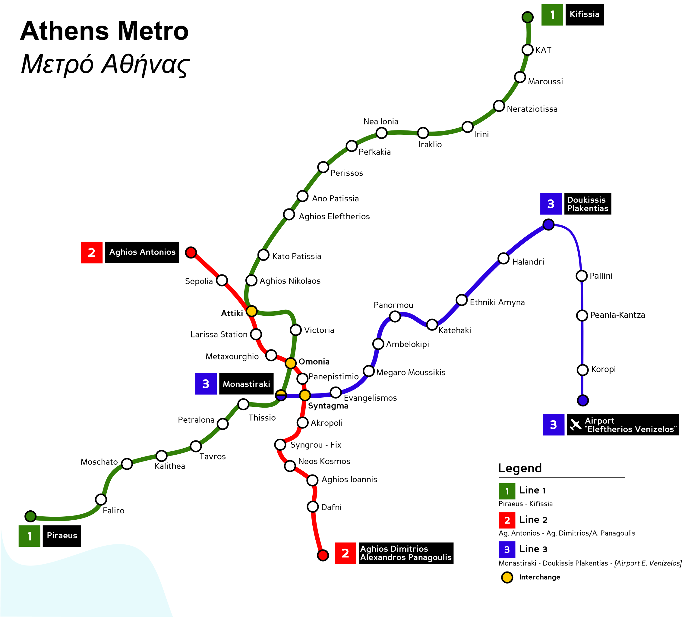
Athens Metro map. |
| ⧼wm-license-information-date⧽ | |
| ⧼wm-license-information-source⧽ | Based on several maps in the Internet. |
| ⧼wm-license-information-author⧽ | Original map by Mortadelo2005. Updated map that includes the three stations of Pallini, Peania-Kantza, and Koropi by NerdyNSK (Nikolaos S. Karastathis or NSK). |
|
|
This image was created with Inkscape. |
ترخيص
قالب:Cc-by-sa-3.0-migrated |

The updated map created by User:NerdyNSK that includes the stations of Pallini, Peania-Kantza, and Koropi is also released under the same licences as the original (GFDL 1.2, CC-BY 2.5).
تاريخ الملف
اضغط على زمن/تاريخ لرؤية الملف كما بدا في هذا الزمن.
| زمن/تاريخ | صورة مصغرة | الأبعاد | مستخدم | تعليق | |
|---|---|---|---|---|---|
| حالي | ★ مراجعة معتمدة 16:43، 13 ديسمبر 2023 | | 1٬560 × 1٬400 (661 كيلوبايت) | Pastakhov (نقاش | مساهمات) | Upload https://upload.wikimedia.org/wikipedia/commons/9/96/Athens_Metro_map_%282007%29.svg |
لا يمكنك استبدال هذا الملف.
وصلات
لا يوجد صفحات تصل لهذه الصورة.
.svg&oldid=3764084)