ملف:Ashanti districts.png
الملف الأصلي (1٬056 × 816 بكسل حجم الملف: 56 كيلوبايت، نوع MIME: image/png)
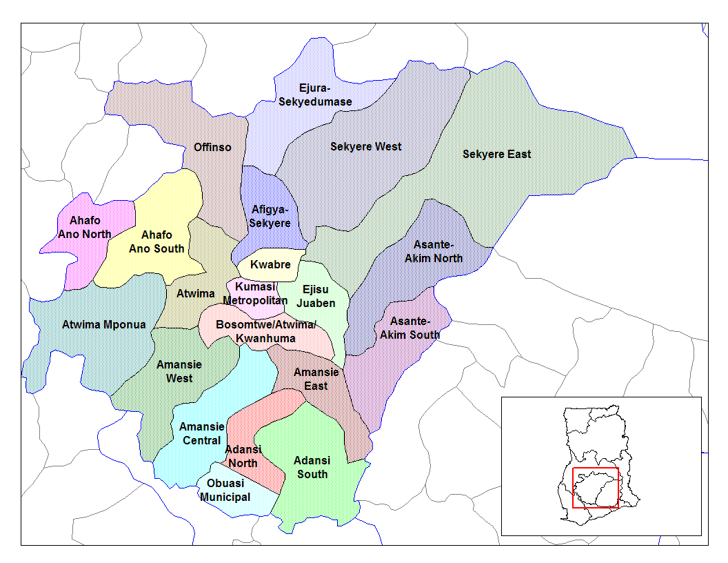
Ashanti Region
وصف قصير
Map of the districts of Ashanti region Asanteman, Ghana. Created by Rarelibra for public domain use. Created using MapInfo Professional v7.5 and various mapping resources.
Licensing Public domain
I, the creator of this work, hereby release it into the public domain. This applies worldwide. In case this is not legally possible, I grant any entity the right to use this work for any purpose, without any conditions, unless such conditions are required by law.
File history
Legend: (cur) = this is the current file, (del) = delete this old version, (rev) = revert to this old version. Click on date to download the file or see the image uploaded on that date.
- 06:57, 5 March 2006 . . . 1056x816 (57,074 bytes) (Map of the districts of Ashanti region Asanteman, Ghana. Created by Rarelibra for public domain use. Created using MapInfo Professional v7.5 and various mapping resources.)
ترخيص
تاريخ الملف
اضغط على زمن/تاريخ لرؤية الملف كما بدا في هذا الزمن.
| زمن/تاريخ | صورة مصغرة | الأبعاد | مستخدم | تعليق | |
|---|---|---|---|---|---|
| حالي | ★ مراجعة معتمدة 18:51، 23 نوفمبر 2023 | | 1٬056 × 816 (56 كيلوبايت) | Pastakhov (نقاش | مساهمات) | Upload https://upload.wikimedia.org/wikipedia/commons/3/33/Ashanti_districts.png |
لا يمكنك استبدال هذا الملف.
وصلات
لا يوجد صفحات تصل لهذه الصورة.