ملف:Argentine Confederation and BuenosAires 1858.jpg
لا توجد دقة أعلى متوفرة.
Argentine_Confederation_and_BuenosAires_1858.jpg (308 × 317 بكسل حجم الملف: 43 كيلوبايت، نوع MIME: image/jpeg)
| ⧼wm-license-information-description⧽ |
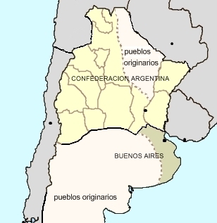
Constitutional Argentine Confederation and independent Buenos Aires Province, 1858. |
| ⧼wm-license-information-date⧽ | 2009-12-26 15:43 (UTC) |
| ⧼wm-license-information-source⧽ | |
| ⧼wm-license-information-author⧽ |
|
| [This is a retouched picture, which means that it has been digitally altered from its original version. The original can be viewed here: Mapa_Argentina_vs_BuenosAires_1858.jpg.] Error: {{Lang}}: text has italic markup (help)
|
قالب:Original upload log
This image is a derivative work of the following images:
- File:Mapa_Argentina_vs_BuenosAires_1858.jpg licensed with Cc-by-2.5
- 2007-03-21T03:36:02Z Pruxo 310x599 (90348 Bytes) mapa de la confederacion argentina y el estado porteño durante su secesion (1853-1861) trabajo propio de documentación historica 2007 autor : PRUXO mapa:tomando como base a: Image:Argentina provinces, blank.png A map of
تاريخ الملف
اضغط على زمن/تاريخ لرؤية الملف كما بدا في هذا الزمن.
| زمن/تاريخ | صورة مصغرة | الأبعاد | مستخدم | تعليق | |
|---|---|---|---|---|---|
| حالي | ★ مراجعة معتمدة 14:36، 25 أكتوبر 2023 | | 308 × 317 (43 كيلوبايت) | Pastakhov (نقاش | مساهمات) | Upload https://upload.wikimedia.org/wikipedia/commons/2/23/Argentine_Confederation_and_BuenosAires_1858.jpg |
لا يمكنك استبدال هذا الملف.
وصلات
لا يوجد صفحات تصل لهذه الصورة.