ملف:Archipel toscan carte-fr.png
حجم هذه المعاينة: 800 × 550 بكسل. البعد الآخر: 1٬000 × 687 بكسل.
الملف الأصلي (1٬000 × 687 بكسل حجم الملف: 169 كيلوبايت، نوع MIME: image/png)
| ⧼wm-license-information-description⧽ |
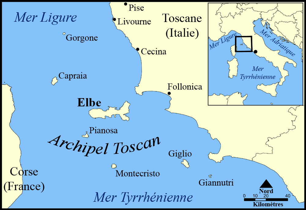
This map shows the islands of the Tuscan archipelago, including Elba, Capraia, Giglio, Montecristo, Pianosa, Gorgona, and Giannutri. Translated into french. |
| ⧼wm-license-information-date⧽ | original upload was 20 mai 2005. Lilyu's version (translation into french) 10 october 2008 |
| ⧼wm-license-information-source⧽ | own work on Image:Tuscan archipelago blank map.png by NormanEinstein (GFDL V1.2 and later), derivated from Image:Tuscan archipelago.png by Airunp (released in public domain) which uploaded it from en:Image:Tuscan archipelago.png, and which was modified by NormanEinstein. |
| ⧼wm-license-information-author⧽ | Lilyu, NormanEinstein, Airunp |
| ⧼wm-license-information-other-versions⧽ |
Image:Tuscan archipelago blank map.png & Image:Tuscan archipelago.png |

|
تاريخ الملف
اضغط على زمن/تاريخ لرؤية الملف كما بدا في هذا الزمن.
| زمن/تاريخ | صورة مصغرة | الأبعاد | مستخدم | تعليق | |
|---|---|---|---|---|---|
| حالي | ★ مراجعة معتمدة 09:56، 13 نوفمبر 2023 | | 1٬000 × 687 (169 كيلوبايت) | Pastakhov (نقاش | مساهمات) | Upload https://upload.wikimedia.org/wikipedia/commons/3/38/Archipel_toscan_carte-fr.png |
لا يمكنك استبدال هذا الملف.
وصلات
لا يوجد صفحات تصل لهذه الصورة.