ملف:Appanoose County Community Railroad system map.svg

حجم معاينة PNG لذلك الملف ذي الامتداد SVG: 800 × 457 بكسل. البعد الآخر: 2٬560 × 1٬463 بكسل.
الملف الأصلي (ملف SVG، أبعاده 1٬400 × 800 بكسل، حجم الملف: 405 كيلوبايت)
وصف قصير
| ⧼wm-license-information-description⧽ |
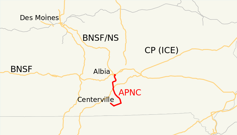
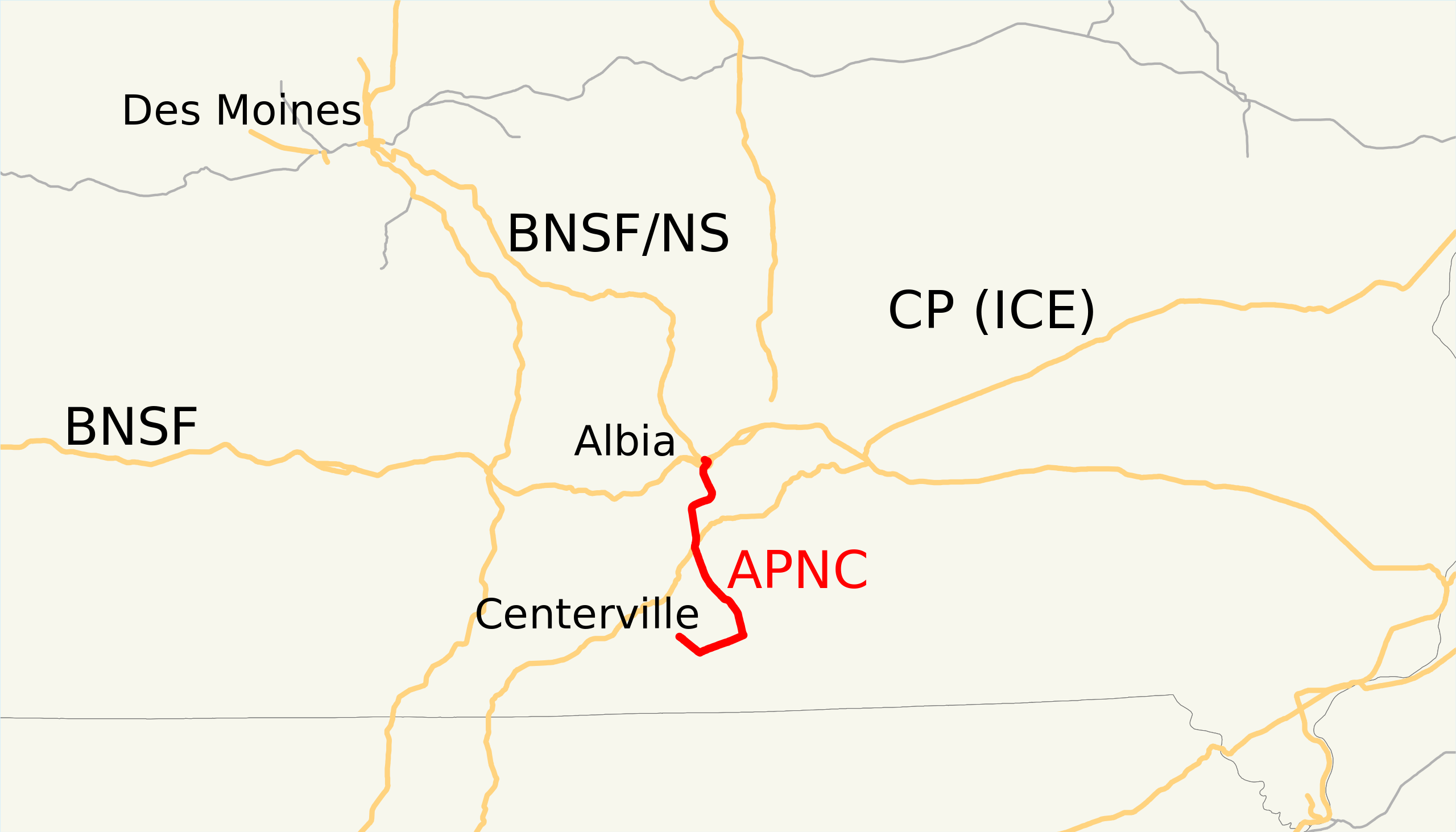
This is a map of the Appanoose County Community Railroad as of 2009, with other railroads in gray (Class I railroads in orange). Email me if you would like a copy of the GIS data I created (modified from Bureau of Transportation Statistics North American Transportation Atlas Data) or if you see any errors. |
| ⧼wm-license-information-date⧽ | قالب:Original upload date |
| ⧼wm-license-information-source⧽ | No machine-readable source provided. Own work assumed (based on copyright claims). |
| ⧼wm-license-information-author⧽ | No machine-readable author provided. NE2 assumed (based on copyright claims). |
ترخيص
تاريخ الملف
اضغط على زمن/تاريخ لرؤية الملف كما بدا في هذا الزمن.
| زمن/تاريخ | صورة مصغرة | الأبعاد | مستخدم | تعليق | |
|---|---|---|---|---|---|
| حالي | ★ مراجعة معتمدة 18:53، 1 نوفمبر 2023 | | 1٬400 × 800 (405 كيلوبايت) | Pastakhov (نقاش | مساهمات) | Upload https://upload.wikimedia.org/wikipedia/commons/f/f5/Appanoose_County_Community_Railroad_system_map.svg |
لا يمكنك استبدال هذا الملف.
وصلات
لا يوجد صفحات تصل لهذه الصورة.