ملف:AnacondaAreaOfOperations.jpg
حجم هذه المعاينة: 800 × 522 بكسل. البعد الآخر: 1٬354 × 883 بكسل.
الملف الأصلي (1٬354 × 883 بكسل حجم الملف: 1٫06 ميجابايت، نوع MIME: image/jpeg)
وصف قصير
| ⧼wm-license-information-description⧽ |
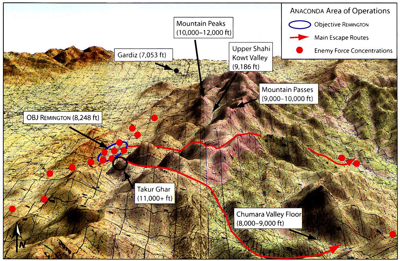
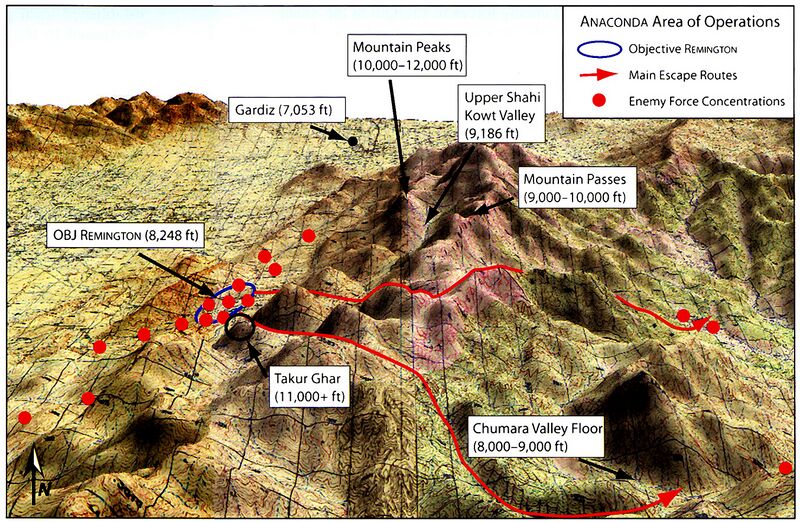
English: Strategic map for U.S. Army operation Anaconda. The area outlined in blue is the Shahi Kowt Valley, about one hundred miles south of Kabul, Afghanistan, near the Pakistani border.
|
| ⧼wm-license-information-date⧽ | 2006 |
| ⧼wm-license-information-source⧽ | U.S. Army brochure the United States Army in Afghanistan |
| ⧼wm-license-information-author⧽ | U.S. Army |
| ⧼wm-license-information-permission⧽ (⧼wm-license-information-permission-reusing-text⧽) |
PD-USGOV. |
ترخيص
قالب:Original upload log
قالب:Original description page
- 2007-04-20 23:03 Victor falk 1354×883×8 (1107603 bytes) '''Sourced from:''' http://www.army.mil/cmh/brochures/Afghanistan/Operation%20Enduring%20Freedom.htm
تاريخ الملف
اضغط على زمن/تاريخ لرؤية الملف كما بدا في هذا الزمن.
| زمن/تاريخ | صورة مصغرة | الأبعاد | مستخدم | تعليق | |
|---|---|---|---|---|---|
| حالي | ★ مراجعة معتمدة 05:15، 16 يناير 2024 | | 1٬354 × 883 (1٫06 ميجابايت) | Pastakhov (نقاش | مساهمات) | Upload https://upload.wikimedia.org/wikipedia/commons/5/5f/AnacondaAreaOfOperations.jpg |
لا يمكنك استبدال هذا الملف.
وصلات
لا يوجد صفحات تصل لهذه الصورة.